Area Overview for LL12 7HP
Photos of LL12 7HP
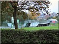
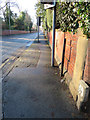
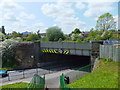
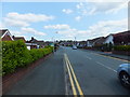
26 photos from this area
Area Information
Key information about the LL12 7HP including its size, population, and administrative classification.
- Area Type
- Postcode
- Area Size
- 1.0 hectares
- Population
- 1535
- Population Density
- 4856 people/km²
House Prices in LL12 7HP
28
Properties
£114,929
Average Sold Price
£30,500
Lowest Price
£208,000
Highest Price
Showing 28 properties
| Address | Type | Beds | Baths | Last Sale Price | Last Sale Date | |
|---|---|---|---|---|---|---|
| 1 Yale Grove, Wrexham, LL12 7HP | Semi-detached | 3 | 1 | £208,000 | Jan 2023 | |
| 13 Yale Grove, Wrexham, LL12 7HP | Semi-detached | 3 | 2 | £110,000 | Aug 2022 | |
| 4 Yale Grove, Wrexham, LL12 7HP | house | - | - | £153,000 | Dec 2020 | |
| 17 Yale Grove, Wrexham, LL12 7HP | Semi-detached | 3 | 1 | £136,500 | Apr 2019 | |
| 25 Yale Grove, Wrexham, LL12 7HP | house | - | - | £100,000 | Nov 2018 | |
| 22 Yale Grove, Wrexham, LL12 7HP | Semi-detached | 3 | 2 | £113,000 | Nov 2017 | |
| 2 Yale Grove, Wrexham, LL12 7HP | house | 3 | - | £122,000 | Nov 2011 | |
| 7 Yale Grove, Wrexham, LL12 7HP | house | 3 | - | £133,000 | Jun 2010 | |
| 11 Yale Grove, Wrexham, LL12 7HP | Semi-detached | - | - | £140,000 | Dec 2008 | |
| 20 Yale Grove, Wrexham, LL12 7HP | Semi-detached | - | - | £125,000 | Sep 2007 |
Page 1 of 3
Energy Efficiency in LL12 7HP
Amenities
Schools
| Rank | School | Type | Entry gender | Ages |
|---|
Explore more schools in this area
Go to Schools tabDemographics
Household Size
One person
most common
Accommodation Type
Houses
most common
Tenure
45
majority
Ethnic Group
White
most common
Religion
N/A
most common
Household Composition
N/A
most common
Age
47
median
Adults (30-64 years)
most common
Household Deprivation
N/A
with no deprivation
NS-SEC
18
in Lower managerial occupations
Explore more demographic insights in this area
Go to Demographics tabPlanning
Planning Constraints
- Flood RiskPremium
- Ramsar Wetland SitesPremium
- Area of Outstanding Natural BeautyPremium
- Protected Nature ReservePremium
- Protected WoodlandPremium
- Crime RiskPremium