Area Overview for LL12 7AQ
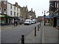
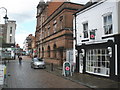
Photos of LL12 7AQ


Area Information
Living in LL12 7AQ means being part of a small, tightly knit residential cluster in north Wales. With a population of 1,937, this area offers a quiet, community-focused lifestyle. The demographic profile suggests a stable, middle-aged population, with adults aged 30–64 forming the majority. Daily life here is shaped by proximity to essential services, including retail outlets like Lidl Wrexham and Asda Wrexham, and easy access to rail networks. The area’s digital connectivity is strong, with a broadband score of 96 and mobile coverage of 83, ensuring reliable internet for both work and leisure. While the postcode covers a limited geographic footprint, its strategic location near Wrexham provides access to broader urban amenities without the congestion of larger cities. For those seeking a balance between rural tranquillity and urban convenience, LL12 7AQ offers a distinct blend of practicality and accessibility.
- Area Type
- Postcode
- Area Size
- Not available
- Population
- 1937
- Population Density
- 2857 people/km²
The property market in LL12 7AQ is characterised by a high rate of home ownership, with 68% of residents living in their own homes. This suggests a stable, owner-occupied market rather than a rental-heavy area. The predominant accommodation type is houses, which aligns with the small, residential nature of the postcode. Given the limited population and compact size of the area, the housing stock is likely to be modest in scale, with fewer high-density developments. For buyers, this means a focus on individual properties rather than apartments or shared housing. The proximity to Wrexham’s rail network and retail hubs may enhance the appeal of homes here, though the small size of the area means competition for available properties could be keen.
House Prices in LL12 7AQ
No properties found in this postcode.
Energy Efficiency in LL12 7AQ
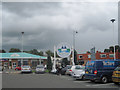
The lifestyle in LL12 7AQ is shaped by its proximity to retail and transport hubs. Residents have access to five retail outlets, including Lidl Wrexham and Spar, which provide everyday shopping needs. The nearby rail stations, such as Wrexham General Railway Station, offer convenient links to urban centres. While the area itself is small, its location near Wrexham ensures access to a wider range of amenities, from dining options to leisure facilities. The presence of multiple retail and transport points within walking or short driving distance enhances the convenience of daily life. However, the data does not mention parks or recreational spaces, so outdoor activities may require travel to nearby areas.
Amenities
Schools
Residents of LL12 7AQ have access to two named schools: Alexandra C.P. School and The Groves High School. Both are listed as 'other' in terms of type, though specific Ofsted ratings are not provided. The presence of a primary school and a high school within the area suggests a comprehensive educational offering for families. This mix of school types may reduce the need for long commutes, allowing children to attend local institutions. However, without additional data on performance or capacity, prospective families should consider visiting the schools directly to assess their suitability. The availability of both primary and secondary education within the vicinity is a practical advantage for households with children.
| Rank | School | Type | Entry gender | Ages |
|---|
Explore more schools in this area
Go to Schools tabDemographics
The community in LL12 7AQ is predominantly composed of adults aged 30–64, with a median age of 47. This suggests a mature, established population, likely with long-term ties to the area. Home ownership is high, at 68%, indicating a stable housing market where most residents live in their own homes rather than renting. The accommodation type is primarily houses, reflecting a low-density, suburban character. The predominant ethnic group is White, though specific data on diversity or deprivation is not provided. The age profile and ownership rates suggest a community focused on long-term residency, with fewer transient populations. This demographic structure may influence local services and amenities, aligning them with the needs of middle-aged households rather than younger families or retirees.
Household Size
Accommodation Type
Tenure
Ethnic Group
Religion
Household Composition
Age
Household Deprivation
NS-SEC
Explore more demographic insights in this area
Go to Demographics tabPlanning
Planning Constraints
- Flood RiskPremium
- Ramsar Wetland SitesPremium
- Area of Outstanding Natural BeautyPremium
- Protected Nature ReservePremium
- Protected WoodlandPremium
- Crime RiskPremium