Area Overview for LL11 6RL
Photos of LL11 6RL
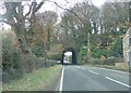
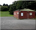
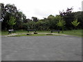
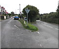
24 photos from this area
Area Information
Key information about the LL11 6RL including its size, population, and administrative classification.
- Area Type
- Postcode
- Area Size
- 1.1 hectares
- Population
- 1748
- Population Density
- 1955 people/km²
House Prices in LL11 6RL
37
Properties
£75,156
Average Sold Price
£25,500
Lowest Price
£112,000
Highest Price
Showing 37 properties
| Address | Type | Beds | Baths | Last Sale Price | Last Sale Date | |
|---|---|---|---|---|---|---|
| 80 Bryn Hedd, Southsea, Wrexham, LL11 6RL | Terraced | 3 | 1 | £101,500 | Oct 2020 | |
| 46 Bryn Hedd, Southsea, Wrexham, LL11 6RL | Semi-detached | 3 | - | £112,000 | Apr 2018 | |
| 52 Bryn Hedd, Southsea, Wrexham, LL11 6RL | Terraced | 3 | - | £95,000 | Jan 2017 | |
| 62 Bryn Hedd, Southsea, Wrexham, LL11 6RL | Terraced | 3 | 1 | £88,500 | Aug 2016 | |
| 88 Bryn Hedd, Southsea, Wrexham, LL11 6RL | Semi-detached | 3 | - | £105,000 | Nov 2014 | |
| 60 Bryn Hedd, Southsea, Wrexham, LL11 6RL | Terraced | 3 | - | £66,001 | Jan 2014 | |
| 84 Bryn Hedd, Southsea, Wrexham, LL11 6RL | Terraced | - | - | £60,000 | Sep 2003 | |
| 56 Bryn Hedd, Southsea, Wrexham, LL11 6RL | Terraced | - | - | £68,000 | Jul 2003 | |
| 66 Bryn Hedd, Southsea, Wrexham, LL11 6RL | Semi-detached | - | - | £30,063 | Jun 2003 | |
| 75 Bryn Hedd, Southsea, Wrexham, LL11 6RL | Terraced | - | - | £25,500 | Jan 2000 |
Page 1 of 4
Energy Efficiency in LL11 6RL
Amenities
Schools
| Rank | School | Type | Entry gender | Ages |
|---|
Explore more schools in this area
Go to Schools tabDemographics
Household Size
Family (3-5 people)
most common
Accommodation Type
Houses
most common
Tenure
50
majority
Ethnic Group
White
most common
Religion
N/A
most common
Household Composition
N/A
most common
Age
47
median
Adults (30-64 years)
most common
Household Deprivation
N/A
with no deprivation
NS-SEC
17
in Lower managerial occupations
Explore more demographic insights in this area
Go to Demographics tabPlanning
Planning Constraints
- Flood RiskPremium
- Ramsar Wetland SitesPremium
- Area of Outstanding Natural BeautyPremium
- Protected Nature ReservePremium
- Protected WoodlandPremium
- Crime RiskPremium