Area Overview for LL11 5FS
Photos of LL11 5FS
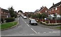
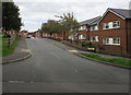
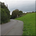
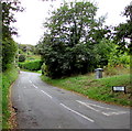
52 photos from this area
Area Information
Key information about the LL11 5FS including its size, population, and administrative classification.
- Area Type
- Postcode
- Area Size
- 25.8 hectares
- Population
- 2819
- Population Density
- 439 people/km²
House Prices in LL11 5FS
35
Properties
£198,155
Average Sold Price
£115,000
Lowest Price
£310,000
Highest Price
Showing 35 properties
| Address | Type | Beds | Baths | Last Sale Price | Last Sale Date | |
|---|---|---|---|---|---|---|
| 43 Clifton Avenue, Brymbo, Wrexham, LL11 5FS | Semi-detached | 3 | 2 | £217,000 | Nov 2025 | |
| 57 Clifton Avenue, Brymbo, Wrexham, LL11 5FS | house | - | - | £306,000 | Sep 2025 | |
| 3 Clifton Avenue, Brymbo, Wrexham, LL11 5FS | Detached | 4 | 3 | £310,000 | Apr 2025 | |
| 31 Clifton Avenue, Brymbo, Wrexham, LL11 5FS | Detached | 4 | 4 | £278,000 | Nov 2024 | |
| 29 Clifton Avenue, Brymbo, Wrexham, LL11 5FS | Detached | 4 | 1 | £275,000 | Jun 2024 | |
| 10 Clifton Avenue, Brymbo, Wrexham, LL11 5FS | Detached | 3 | 2 | £212,000 | Nov 2022 | |
| 1 Clifton Avenue, Brymbo, Wrexham, LL11 5FS | Retail | 4 | 3 | £310,000 | May 2022 | |
| 19 Clifton Avenue, Brymbo, Wrexham, LL11 5FS | house | - | - | £115,000 | Oct 2020 | |
| 7 Clifton Avenue, Brymbo, Wrexham, LL11 5FS | Detached | 3 | 2 | £195,000 | Apr 2020 | |
| 5 Clifton Avenue, Brymbo, Wrexham, LL11 5FS | house | - | - | £185,000 | Sep 2019 |
Page 1 of 4
Energy Efficiency in LL11 5FS
Amenities
Schools
| Rank | School | Type | Entry gender | Ages |
|---|
Explore more schools in this area
Go to Schools tabDemographics
Household Size
Family (3-5 people)
most common
Accommodation Type
Houses
most common
Tenure
71
majority
Ethnic Group
White
most common
Religion
N/A
most common
Household Composition
N/A
most common
Age
47
median
Adults (30-64 years)
most common
Household Deprivation
N/A
with no deprivation
NS-SEC
34
in Lower managerial occupations
Explore more demographic insights in this area
Go to Demographics tabPlanning
Planning Constraints
- Flood RiskPremium
- Ramsar Wetland SitesPremium
- Area of Outstanding Natural BeautyPremium
- Protected Nature ReservePremium
- Protected WoodlandPremium
- Crime RiskPremium