Area Overview for LL11 2BD
Photos of LL11 2BD
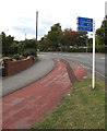
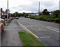
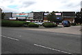
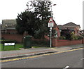
58 photos from this area
Area Information
Key information about the LL11 2BD including its size, population, and administrative classification.
- Area Type
- Postcode
- Area Size
- 9298 m²
- Population
- 2286
- Population Density
- 1321 people/km²
House Prices in LL11 2BD
24
Properties
£163,315
Average Sold Price
£48,500
Lowest Price
£250,000
Highest Price
Showing 24 properties
| Address | Type | Beds | Baths | Last Sale Price | Last Sale Date | |
|---|---|---|---|---|---|---|
| 14 Windsor Drive, Wrexham, LL11 2BD | Semi-detached | 3 | 1 | £207,000 | Nov 2024 | |
| 10 Windsor Drive, Wrexham, LL11 2BD | Semi-detached | 3 | 3 | £250,000 | Aug 2024 | |
| 11A Windsor Drive, Wrexham, LL11 2BD | house | - | - | £239,950 | Mar 2022 | |
| 20 Windsor Drive, Wrexham, LL11 2BD | house | - | - | £236,000 | Jun 2021 | |
| 25 Windsor Drive, Wrexham, LL11 2BD | house | - | - | £209,950 | Mar 2021 | |
| 12 Windsor Drive, Wrexham, LL11 2BD | Semi-detached | 3 | - | £167,000 | May 2018 | |
| 18 Windsor Drive, Wrexham, LL11 2BD | house | 3 | 2 | £175,000 | Dec 2017 | |
| 8 Windsor Drive, Wrexham, LL11 2BD | house | - | - | £141,000 | Nov 2016 | |
| 19 Windsor Drive, Wrexham, LL11 2BD | house | - | - | £189,950 | Oct 2016 | |
| 23 Windsor Drive, Wrexham, LL11 2BD | Semi-detached | 3 | - | £178,000 | Jul 2016 |
Page 1 of 3
Energy Efficiency in LL11 2BD
Amenities
Schools
| Rank | School | Type | Entry gender | Ages |
|---|
Explore more schools in this area
Go to Schools tabDemographics
Household Size
One person
most common
Accommodation Type
Houses
most common
Tenure
60
majority
Ethnic Group
White
most common
Religion
N/A
most common
Household Composition
N/A
most common
Age
47
median
Adults (30-64 years)
most common
Household Deprivation
N/A
with no deprivation
NS-SEC
30
in Lower managerial occupations
Explore more demographic insights in this area
Go to Demographics tabPlanning
Planning Constraints
- Flood RiskPremium
- Ramsar Wetland SitesPremium
- Area of Outstanding Natural BeautyPremium
- Protected Nature ReservePremium
- Protected WoodlandPremium
- Crime RiskPremium