Area Overview for LL11 1UX
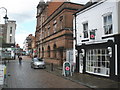
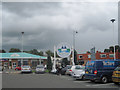
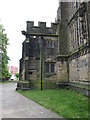
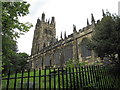
Photos of LL11 1UX


Area Information
Living in LL11 1UX means being part of a small, tightly knit residential cluster in north Wales. With a population of 1,524, this area is characterised by a quiet, community-focused lifestyle. The demographic profile suggests a mature population, with a median age of 47 and most residents falling within the 30-64 age range. This reflects a stable, established community, likely centred around local employment or nearby towns. The area’s compact size means amenities and services are within practical reach, though its small footprint also means it is best suited for those prioritising proximity to transport links and retail hubs. LL11 1UX is not a sprawling suburb but a focused postcode area, ideal for those seeking a low-key, residential environment with minimal urban sprawl. Its location in Wales offers a distinct cultural and geographical identity, with access to natural landscapes and historic sites nearby. For buyers, the area’s limited size means properties are likely to be in close proximity to one another, creating a sense of familiarity among residents.
- Area Type
- Postcode
- Area Size
- Not available
- Population
- 1524
- Population Density
- 1766 people/km²
The property market in LL11 1UX is shaped by its small size and the dominance of flats as the primary accommodation type. With only 31% of homes owned by residents, the area leans heavily towards rental properties, suggesting a market more suited to tenants than buyers seeking long-term ownership. The prevalence of flats indicates a focus on compact, efficient living spaces, which may appeal to those prioritising affordability or ease of maintenance. Given the area’s limited size, the housing stock is unlikely to be extensive, meaning buyers should consider nearby postcode areas for a broader selection. For those interested in purchasing, the low home ownership rate may reflect either a transient population or a reliance on rental options. The small scale of LL11 1UX also means property values are likely to be influenced by proximity to transport links and local amenities, which are critical for residents in this tightly contained postcode.
House Prices in LL11 1UX
No properties found in this postcode.
Energy Efficiency in LL11 1UX
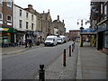
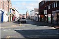
The lifestyle in LL11 1UX is supported by a range of nearby amenities, including five retail outlets such as Co-op Lord, Heron Wrexham, and Iceland Wrexham. These shops provide access to essential goods, groceries, and household items, reducing the need for long trips to larger centres. The area’s proximity to multiple railway stations, including Wrexham Central and Gwersyllt, enhances its connectivity, allowing residents to easily reach cultural, leisure, and professional opportunities in surrounding towns. While the data does not specify parks or leisure facilities within the immediate area, the presence of retail and rail options suggests a practical, service-oriented daily life. The combination of local shops and efficient transport links creates a convenient environment for residents, balancing accessibility with the quiet, residential character of the postcode.
Amenities
Schools
The nearest school to LL11 1UX is Ysgol Plas Coch, which is categorised as an 'other' type. While no Ofsted rating is provided in the data, the presence of a single school suggests that families in the area may need to consider additional educational options beyond this institution. The school’s classification as 'other' could indicate it serves a specific demographic or offers specialist provision, though details are not specified. For parents, this means the school mix is limited, and families may need to look further afield for a range of educational choices. The absence of multiple schools in the immediate vicinity could be a consideration for those prioritising access to a variety of schools. However, the area’s proximity to larger towns may offer more options for students requiring alternative schooling.
| Rank | School | Type | Entry gender | Ages |
|---|
Explore more schools in this area
Go to Schools tabDemographics
The community in LL11 1UX is predominantly composed of adults aged 30-64, with a median age of 47. This suggests a mature population, likely with established careers and long-term ties to the area. Home ownership rates are relatively low at 31%, indicating that a majority of residents are likely to be renting. The primary accommodation type is flats, which aligns with the area’s compact nature and suggests a mix of older housing stock or purpose-built residential developments. The predominant ethnic group is White, reflecting the broader demographic patterns in north Wales. While no specific data on deprivation is provided, the combination of low home ownership and a mature age profile may imply a community with a mix of long-term residents and those in rental accommodation. The absence of detailed diversity metrics means the area’s social composition remains largely defined by its dominant demographic group.
Household Size
Accommodation Type
Tenure
Ethnic Group
Religion
Household Composition
Age
Household Deprivation
NS-SEC
Explore more demographic insights in this area
Go to Demographics tabPlanning
Planning Constraints
- Flood RiskPremium
- Ramsar Wetland SitesPremium
- Area of Outstanding Natural BeautyPremium
- Protected Nature ReservePremium
- Protected WoodlandPremium
- Crime RiskPremium