Area Overview for LL11 1SR
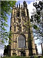
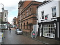
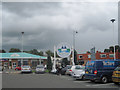
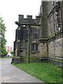
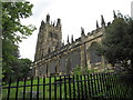
Photos of LL11 1SR


Area Information
Living in LL11 1SR means being part of a small, tightly knit residential cluster in Wales, with a population of 1,825. This area is characterised by its modest scale, where daily life revolves around local amenities and community connections. The demographic profile suggests a mature population, with a median age of 47 and a majority of residents aged 30–64. While the area is predominantly home to owner-occupied properties, 28% of households are owner-occupied, indicating a mix of rental and private residences. The residential character is defined by houses rather than flats, reflecting a traditional, low-density layout. For those seeking a quiet, established neighbourhood with practical access to nearby towns, LL11 1SR offers a blend of simplicity and proximity to essential services. Its small size means residents are likely to know their neighbours, and the area’s limited environmental constraints—no protected sites or natural beauty designations—suggest a straightforward planning environment. However, its remoteness from major cities may appeal to those prioritising peace and space over urban vibrancy.
- Area Type
- Postcode
- Area Size
- Not available
- Population
- 1825
- Population Density
- 2498 people/km²
The property market in LL11 1SR is defined by a low home ownership rate of 28%, indicating that the majority of properties are rented rather than owned. This suggests a rental market that may attract tenants seeking affordable housing in a quiet, residential setting. The accommodation type is primarily houses, which are more common than flats or apartments, reflecting the area’s traditional layout. For buyers, this means a limited selection of owner-occupied homes, with a focus on single-family residences. The small size of the area means property choices are constrained, and buyers may need to consider nearby towns for a broader range of options. The market’s character is one of simplicity, with homes likely to be older and requiring maintenance, appealing to those prioritising space and a slower pace of life.
House Prices in LL11 1SR
No properties found in this postcode.
Energy Efficiency in LL11 1SR
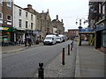
Residents of LL11 1SR have access to a range of nearby amenities, including retail outlets such as Iceland Wrexham, Heron Wrexham, and Co-op Lord, which offer grocery and everyday shopping needs. The area’s rail stations—Wrexham Central, Wrexham General, and Gwersyllt—provide easy access to regional transport, enabling commuting to nearby towns. While the data does not mention parks or leisure facilities, the presence of retail and rail options suggests a practical, service-oriented lifestyle. The small size of the area means amenities are concentrated, making daily errands efficient. However, those seeking extensive recreational spaces may need to travel further afield. The combination of local shops and transport links creates a self-contained, low-maintenance environment.
Amenities
Schools
The nearest educational facility to LL11 1SR is Woodlands Children’s Development Centre, categorised as an ‘other’ type. No specific Ofsted rating is provided, so its quality or performance cannot be assessed from the data. The absence of other schools in the immediate vicinity suggests that families may need to look beyond the area for primary or secondary education options. This could be a consideration for prospective buyers with children, as the limited local school infrastructure may require commuting to nearby towns. The data does not indicate the presence of state or independent schools, meaning further research would be necessary to evaluate educational opportunities fully.
| Rank | School | Type | Entry gender | Ages |
|---|
Explore more schools in this area
Go to Schools tabDemographics
The community in LL11 1SR is predominantly composed of adults aged 30–64, with a median age of 47. This suggests a mature population, likely with established careers and family structures. Home ownership stands at 28%, which is relatively low, pointing to a rental market that may cater to younger professionals or those seeking temporary housing. The accommodation type is primarily houses, which aligns with the area’s low-density residential profile. The predominant ethnic group is White, reflecting a homogenous demographic. While no specific data on deprivation or diversity is provided, the figures imply a stable, middle-aged population with a focus on long-term housing needs. The absence of detailed diversity statistics means the community’s social fabric remains largely unexplored in this context.
Household Size
Accommodation Type
Tenure
Ethnic Group
Religion
Household Composition
Age
Household Deprivation
NS-SEC
Explore more demographic insights in this area
Go to Demographics tabPlanning
Planning Constraints
- Flood RiskPremium
- Ramsar Wetland SitesPremium
- Area of Outstanding Natural BeautyPremium
- Protected Nature ReservePremium
- Protected WoodlandPremium
- Crime RiskPremium