Area Overview for LL11 1BW
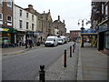
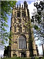
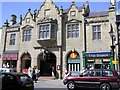
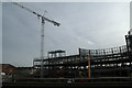
Photos of LL11 1BW

Area Information
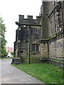
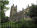
Living in LL11 1BW offers a compact, tightly knit residential experience within a small cluster of homes in north Wales. The area covers 4,314 square metres and is home to 1,524 residents, creating a densely populated yet manageable community. Its location likely places it near larger towns or cities, offering proximity to urban amenities while retaining a quiet, residential character. The demographic profile suggests a mature population, with a median age of 47 and a majority of residents aged between 30 and 64. This age range indicates a community with established professionals and families, potentially contributing to a stable, long-term residential environment. The area’s proximity to rail networks and retail hubs suggests practical connectivity for daily life, while the lack of major environmental constraints means development is likely unimpeded. For buyers, LL11 1BW represents a focused, small-scale area where property choices are limited but may offer opportunities for those seeking a quieter, community-oriented lifestyle.
- Area Type
- Postcode
- Area Size
- 4314 m²
- Population
- 1524
- Population Density
- 1766 people/km²
The property market in LL11 1BW is characterised by a high proportion of flats, with 31% of homes owned by residents rather than rented. This suggests a rental-dominated market, where flats may constitute the majority of available housing stock. The small area size and limited population imply a constrained market, with few properties available for purchase. Buyers should consider the implications of this: limited choices may mean higher competition for available homes, and the focus on flats could appeal to those prioritising low-maintenance living or investment opportunities. The absence of data on property prices or recent transactions means buyers must rely on local agents for current valuations. Given the area’s compact nature, proximity to nearby towns or cities may be a key factor for those seeking more housing options beyond LL11 1BW itself.
House Prices in LL11 1BW
No properties found in this postcode.
Energy Efficiency in LL11 1BW
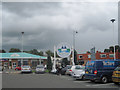
Residents of LL11 1BW have access to a range of nearby amenities, including five retail outlets such as Co-op Lord, Heron Wrexham, and Spar. These shops provide essential services for daily living, from groceries to convenience items. The rail network is particularly well-developed, with five stations within practical reach, including Wrexham General and Gwersyllt. This connectivity allows for easy travel to larger towns for leisure, shopping, or employment. While the data does not mention parks or leisure facilities, the presence of multiple retail and transport options suggests a functional, community-focused lifestyle. The compact nature of the area means amenities are likely concentrated in nearby towns, requiring residents to plan trips accordingly. For those valuing convenience and accessibility, LL11 1BW’s proximity to retail and rail hubs offers a practical balance between local and regional resources.
Amenities
Schools
The nearest school to LL11 1BW is Ysgol Plas Coch, categorised as an ‘other’ school. While no Ofsted rating is provided, the presence of a single school suggests a limited range of educational options for families. The school’s type and location may influence its catchment area, potentially affecting property demand in the vicinity. For families seeking a variety of school types—such as primary, secondary, or specialist institutions—LL11 1BW’s proximity to only one school may require additional research into nearby districts. The lack of data on school performance or capacity means buyers should consult local education authorities for detailed insights. However, the existence of at least one school indicates a basic level of infrastructure to support family living in the area.
| Rank | School | Type | Entry gender | Ages |
|---|
Explore more schools in this area
Go to Schools tabDemographics
The population of LL11 1BW is predominantly composed of adults aged 30–64, reflecting a mature demographic with a median age of 47. This suggests a community with established careers and families, potentially contributing to a stable, long-term residential environment. Home ownership in the area is relatively low at 31%, indicating that a significant proportion of residents are renters. The primary accommodation type is flats, which may reflect a mix of purpose-built housing or conversions. The predominant ethnic group is White, though no specific data on diversity or deprivation is provided. The high population density of 353,247 people per square kilometre underscores the area’s compact nature, which may influence local amenities and social dynamics. For buyers, this profile suggests a community with limited turnover but a focus on long-term residency, potentially appealing to those seeking a settled, low-maintenance lifestyle.
Household Size
Accommodation Type
Tenure
Ethnic Group
Religion
Household Composition
Age
Household Deprivation
NS-SEC
Explore more demographic insights in this area
Go to Demographics tabPlanning
Planning Constraints
- Flood RiskPremium
- Ramsar Wetland SitesPremium
- Area of Outstanding Natural BeautyPremium
- Protected Nature ReservePremium
- Protected WoodlandPremium
- Crime RiskPremium