Area Overview for LL11 1AR
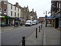
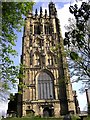
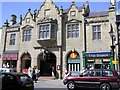
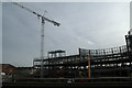
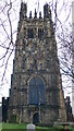
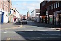
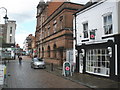
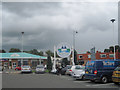
Photos of LL11 1AR

Area Information
LL11 1AR is a compact residential postcode in Wales, covering just 3,170 square metres and home to 1,524 residents. Its high population density of 480,690 people per square kilometre reflects a tightly knit community, with homes clustered closely together. The area is defined by its small scale and practical layout, making it ideal for those seeking a quiet, manageable living environment. Daily life here is shaped by its proximity to essential services, including retail outlets and rail networks, which connect residents to nearby towns. The demographic profile suggests a mature population, with a median age of 47 and a majority of residents aged between 30 and 64. This age group often prioritises convenience and accessibility, traits mirrored in the area’s infrastructure. While the housing stock is predominantly flats, the compact nature of LL11 1AR means residents are never far from local amenities. For those considering living here, the balance of space, community, and connectivity offers a distinct proposition in Wales’s residential landscape.
- Area Type
- Postcode
- Area Size
- 3170 m²
- Population
- 1524
- Population Density
- 1766 people/km²
LL11 1AR’s property market is characterised by a high proportion of rental properties, with only 31% of homes owned outright. The accommodation type is predominantly flats, reflecting the area’s small size and density. This suggests a market skewed towards tenants rather than buyers, particularly for those seeking affordable housing in a compact setting. The limited number of homes available means the area is unlikely to offer a wide range of property choices, and buyers may find themselves competing for a small pool of listings. For those considering purchasing, the prevalence of flats could mean fewer options for larger families or those requiring more space. However, the area’s proximity to transport links and amenities may offset the constraints of its size, making it appealing to those prioritising convenience over expansive living quarters.
House Prices in LL11 1AR
Showing 2 properties
| Address | Type | Beds | Baths | Last Sale Price | Last Sale Date | |
|---|---|---|---|---|---|---|
| Tourist Information Centre, Lambpit Street, Wrexham, LL11 1AR | shop | - | - | - | - | |
| Children And Young People Service, Wrexham County Borough Council, Lambpit Street, Wrexham, LL11 1AR | Office | - | - | - | - |
Energy Efficiency in LL11 1AR
The lifestyle in LL11 1AR is shaped by its proximity to essential amenities, including five retail outlets such as Co-op Lord, Iceland Wrexham, and Lidl Wrexham. These shops provide convenience for daily shopping, from groceries to household items. The area’s rail connections further enhance its appeal, with stations like Wrexham Central and Gwersyllt offering access to broader regional networks. While the data does not mention parks or leisure facilities, the presence of retail and transport options suggests a practical, community-focused lifestyle. The compact nature of the area means residents can access these amenities without long commutes, fostering a sense of local cohesion. However, the absence of specific details on recreational spaces or dining options leaves some aspects of daily life unexplored.
Amenities
Schools
The nearest school to LL11 1AR is Ysgol Plas Coch, which is categorised as an 'other' type in the data. No further details, such as Ofsted ratings or curriculum specifics, are provided. The absence of additional schools in the area means families may need to look beyond LL11 1AR for a broader range of educational options. This could be a consideration for parents seeking diverse school types, such as primary, secondary, or specialist institutions. The single listed school suggests limited local provision, though its exact role in the community remains unclear. For families relying on nearby education, the area’s small size may require careful planning to ensure access to suitable schools within a reasonable distance.
| Rank | School | Type | Entry gender | Ages |
|---|
Explore more schools in this area
Go to Schools tabDemographics
The community in LL11 1AR is predominantly composed of adults aged 30 to 64, with a median age of 47. This suggests a stable population with established careers and families, though the 31% home ownership rate indicates that a significant portion of residents rent their homes. The accommodation type is largely flats, which aligns with the area’s density and compact footprint. Ethnically, the population is overwhelmingly White, with no data provided on other groups. The high population density of 480,690 people per square kilometre implies a closely knit community, though it may also contribute to a sense of limited personal space. For quality of life, the age profile suggests a mix of active professionals and retirees, with potential for community engagement. However, the lack of data on deprivation or diversity means the full picture of socioeconomic factors remains incomplete.
Household Size
Accommodation Type
Tenure
Ethnic Group
Religion
Household Composition
Age
Household Deprivation
NS-SEC
Explore more demographic insights in this area
Go to Demographics tabPlanning
Planning Constraints
- Flood RiskPremium
- Ramsar Wetland SitesPremium
- Area of Outstanding Natural BeautyPremium
- Protected Nature ReservePremium
- Protected WoodlandPremium
- Crime RiskPremium