Area Overview for Hanmer Community

"Amaizeing" in Hanmer Community
Rural lane in March sunshine in Hanmer Community
Footpath off a rural lane in Hanmer Community
Footpath line across a field in Hanmer Community
Country Drive in Hanmer Community
Brook Lane in Hanmer Community
Lane junction in Hanmer Community
The Bank in Hanmer Community
Harbingers of Rain in Hanmer Community
Artists Sky in Hanmer Community
Pallet mending a hole in a hedge in Hanmer Community
Information board on Wrexham On Road Riding Route in Hanmer Community
13 photos from this area

Area Information

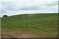
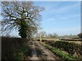
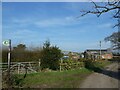
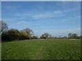
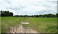
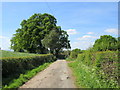
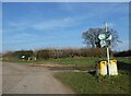
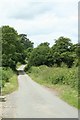
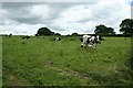
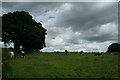
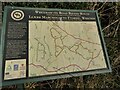
Hanmer Community is a civil parish located in Wrexham County Borough, north-east Wales. This village sits on a glacial moraine at the northern end of Hanmer Mere, situated approximately 16km south-east of Wrexham. The total area spans 18.2 km², offering a rural setting just off the A539 near the Shropshire border. Historically part of the English Maelor, the parish has recorded human activity since at least 1269. You will find heritage sites including the church of St Chad, which dates back to the 12th century, and medieval structures like the Church Cottage, often cited as the oldest house in the village. Daily life here revolves around the linear main street featuring conservation area status. You can view half-timbered and thatched cottages, such as Magpie Cottage, which contribute to the village character. The community feels distinct because of its proximity to the lake and its history of linear development. Living in this parish means engaging with an environment where St Chad's Church stands alongside glacial features. The area remains close to the road network while retaining its historical identity as a settlement defined by its mere and ancient structures.

Area Type
Parish
Area Size
18.2 km²
Population
Not available
Population Density
Not available

Demographics

The community in Hanmer Community reflects a specific demographic profile with a significant proportion of older residents. The data indicates a median age of 70, which suggests that many homes in Hanmer Community are occupied by individuals over that mark. You can expect a population structure where older adults form the core of the resident base compared to many dynamic high-growth towns. Home ownership is the standard here, with figures showing 75% of households own their properties. This high rate indicates a stable, long-term settlement rather than a transient rental market. The accommodation types, household composition, and predominant ethnic groups are recorded in the dataset for the total community, yet specific breakdowns for these categories are not detailed in the provided records. For example, while you know who owns most homes, the exact mix of single-person households versus families is not itemised. This demographic reality shapes the local services and community life, as the population skew toward older ages influences the pace and utility of the village. If you are considering moving, you are looking at an area where property availability often suits older buyers or those seeking a quieter, established environment.

Household Size

total
most common

Accommodation Type

total
most common

Tenure

75
majority

Ethnic Group

total
most common

Religion

total
most common

Household Composition

total
most common

Age

70
median
Age: Total
most common

Household Deprivation

N/A
with no deprivation

NS-SEC

34
in Lower managerial occupations

Explore more demographic insights in this area

Go to Demographics tab

Planning

Planning Constraints

  • Flood Risk
    Premium
  • Ramsar Wetland Sites
    Premium
  • Area of Outstanding Natural Beauty
    Premium
  • Protected Nature Reserve
    Premium
  • Protected Woodland
    Premium
  • Crime Risk
    Premium

Explore more planning insights in this area

Open Planning map

Frequently Asked Questions

What defines the living experience in Hanmer Community?
Living in Hanmer Community means residing in a rural village area covering 18.2 km² with a median age of 70. You gain access to a conservation area featuring St Chad's Church and half-timbered homes, but you must account for a median age of 70 and a mobile network score of 83. Fixed broadband quality remains low at a score of 34. Home ownership stands at 75%, reflecting a settled older population.
Who primarily lives in this area and what does the population look like?
The population in Hanmer Community is characterised by an older demographic with a median age of 70. Most of the population falls into the age categories comprising the total demographic record. You will find that 75% of residents own their homes, indicating a high level of home ownership. While household composition data exists for the total area, the community is clearly defined by this older age profile and the traditional status of its residents in a parish setting.
How reliable is the transport and internet infrastructure for residents?
Transport relies on the A539, connecting Wrexham and Whitchurch, as there is no direct rail service mentioned. Digital connectivity shows a strong mobile coverage score of 83, demonstrating good mobile network quality. However, fixed broadband performance is limited with a score of 34, showing poor quality for internet access. This discrepancy means daily life works well for mobile users but requires caution regarding high-speed wired internet needs.
Are there any environmental or safety risks I should be aware of?
The flooding risk is low, indicated by a score of 6.38. However, planners will note warning levels for Ramsar wetland sites with a score of 3.38 and protected woodland with a score of 4.78. These designations create planning constraints on the land. Crime risk data is not currently available for areas in the region where Hanmer Community sits, so no specific crime score is recorded. The safety profile is otherwise positive regarding flood events, though environmental protections limit development flexibility.

We use cookies to provide you with the best experience. By continuing, you agree to our Cookie Policy .