Area Overview for Cefn Community
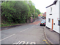
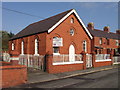
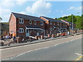
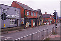
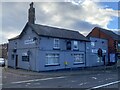
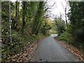
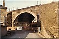
Photos of Cefn Community
Area Information
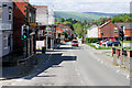
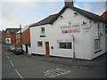
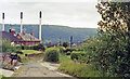
Cefn Community stands as a distinct civil parish in Wales, covering an area of 8.0 km². This rural settlement offers a small-scale living environment defined by its proximity to protected natural spaces. While the location provides access to significant environmental designations, the primary reality for residents is one of quiet isolation within a designated landscape. You will find yourself living in a region where planning constraints play a major role in daily life and future development. The parish is not a bustling urban centre nor a suburban hub; it is a specific geographic entity with fixed boundaries and a population profile that reflects its rural setting. Daily life here revolves around the limited local infrastructure and the surrounding countryside. The presence of an Area of Outstanding Natural Beauty and protected woodlands shapes the visual and structural character of the area significantly. When you consider living in Cefn Community, you are choosing a specific type of countryside living where historic protection measures influence land use. The area's identity is rooted in its official status as a parish within the Welsh administrative landscape. You can expect a neighbourhood where the land itself is a defining feature of the local experience. The combination of rural location and environmental restrictions creates a very specific atmosphere for those who settle here.
- Area Type
- Parish
- Area Size
- 8.0 km²
- Population
- Not available
- Population Density
- Not available
Demographics
The population of Cefn Community has an older demographic profile, with a median age of 70 years. This figure indicates that the majority of residents fall into the senior age bracket. The most common age group recorded covers the total population, reinforcing the dominance of this older demographic in the parish. You are looking at a community where retirees and long-term residents form the core of the social fabric. Home ownership stands at 48%, meaning nearly half of the households own their property outright. The remaining 52% of households are rented, suggesting a significant presence of private or social tenants within this rural parish. Accommodation types reflect a traditional rural mix, though specific breakdowns by property style are not detailed in available records. The household composition is dominated by single-person households, a trend typical of areas with an older population. Deprivation levels are not provided in the current data, so no assessment can be made regarding income inequality or access to services based on financial metrics. You find a neighbourhood where the primary resident demographic is mature adults. The high ratio of owner-occupied homes suggests stability, while the rental component indicates opportunities for those seeking lower entry costs. The community lacks the diversity of age groups found in younger towns, creating a stable but ageing social environment. Your daily interactions here will likely centre on a peer group of similar age and life stage.
Household Size
Accommodation Type
Tenure
Ethnic Group
Religion
Household Composition
Age
Household Deprivation
NS-SEC
Explore more demographic insights in this area
Go to Demographics tabPlanning
Planning Constraints
- Flood RiskPremium
- Ramsar Wetland SitesPremium
- Area of Outstanding Natural BeautyPremium
- Protected Nature ReservePremium
- Protected WoodlandPremium
- Crime RiskPremium