Area Overview for CF71 7TW
Photos of CF71 7TW
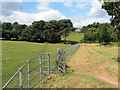
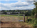
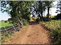
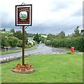
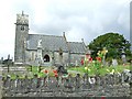
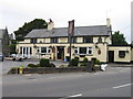
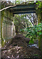
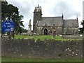
17 photos from this area
Area Information
Key information about the CF71 7TW including its size, population, and administrative classification.
- Area Type
- Postcode
- Area Size
- 13.9 hectares
- Population
- 2308
- Population Density
- 53 people/km²
House Prices in CF71 7TW
45
Properties
£336,926
Average Sold Price
£131,400
Lowest Price
£575,000
Highest Price
Showing 45 properties
| Address | Type | Beds | Baths | Last Sale Price | Last Sale Date | |
|---|---|---|---|---|---|---|
| 27 Badgers Brook Rise, Ystradowen, CF71 7TW | house | - | - | £475,000 | Aug 2025 | |
| 13 Badgers Brook Rise, Ystradowen, CF71 7TW | house | - | - | £455,000 | Aug 2024 | |
| 44 Badgers Brook Rise, Ystradowen, CF71 7TW | house | 4 | 3 | £575,000 | Oct 2022 | |
| 38 Badgers Brook Rise, Ystradowen, CF71 7TW | house | - | - | £430,000 | Apr 2022 | |
| 6 Badgers Brook Rise, Ystradowen, CF71 7TW | Detached | 4 | 2 | £403,000 | Mar 2022 | |
| 45 Badgers Brook Rise, Ystradowen, CF71 7TW | house | - | - | £490,000 | Dec 2021 | |
| Olcote, 3 Badgers Brook Rise, Ystradowen, CF71 7TW | Detached | 4 | 2 | £352,000 | Nov 2020 | |
| 26 Badgers Brook Rise, Ystradowen, CF71 7TW | Detached | 4 | 2 | £359,995 | Mar 2018 | |
| 39 Badgers Brook Rise, Ystradowen, CF71 7TW | house | 4 | 2 | £290,000 | Mar 2018 | |
| 14 Badgers Brook Rise, Ystradowen, CF71 7TW | house | - | - | £385,000 | Dec 2017 |
Page 1 of 5
Energy Efficiency in CF71 7TW
Amenities
Schools
| Rank | School | Type | Entry gender | Ages |
|---|
Explore more schools in this area
Go to Schools tabDemographics
Household Size
Two person
most common
Accommodation Type
Houses
most common
Tenure
88
majority
Ethnic Group
White
most common
Religion
N/A
most common
Household Composition
N/A
most common
Age
47
median
Adults (30-64 years)
most common
Household Deprivation
N/A
with no deprivation
NS-SEC
54
in Lower managerial occupations
Explore more demographic insights in this area
Go to Demographics tabPlanning
Planning Constraints
- Flood RiskPremium
- Ramsar Wetland SitesPremium
- Area of Outstanding Natural BeautyPremium
- Protected Nature ReservePremium
- Protected WoodlandPremium
- Crime RiskPremium