Area Overview for CF71 7SY
Photos of CF71 7SY

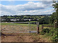
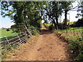
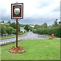

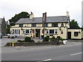

17 photos from this area
Area Information
Key information about the CF71 7SY including its size, population, and administrative classification.
- Area Type
- Postcode
- Area Size
- 1.3 km²
- Population
- 1656
- Population Density
- 80 people/km²
House Prices in CF71 7SY
33
Properties
£547,747
Average Sold Price
£125,000
Lowest Price
£1,385,000
Highest Price
Showing 33 properties
| Address | Type | Beds | Baths | Last Sale Price | Last Sale Date | |
|---|---|---|---|---|---|---|
| Tyn Y Coed, Ty Mawr Close, Ystradowen, CF71 7SY | Semi-detached | 4 | 3 | £435,000 | Dec 2023 | |
| Lawn Cottage, Unnamed Lane From The Paddocks To Longacre, Ystradowen, CF71 7SY | house | - | - | £1,100,000 | Dec 2023 | |
| Kamberg House, Sandy Lane, Ystradowen, CF71 7SY | house | - | - | £635,000 | Sep 2023 | |
| Greendown, Ty Mawr Close, Ystradowen, CF71 7SY | house | - | - | £355,000 | Jan 2022 | |
| Church Farm, Cowbridge Road, Ystradowen, CF71 7SY | Detached | 7 | 4 | £890,000 | Dec 2021 | |
| Ash Cottage, Unnamed Lane From The Paddocks To Longacre, Ystradowen, CF71 7SY | house | - | - | £1,385,000 | Jun 2021 | |
| Tudor Rose Bungalow, Cowbridge Road, Ystradowen, CF71 7SY | Bungalow | - | - | £520,000 | Jun 2021 | |
| The Willows, Cowbridge Road, Ystradowen, CF71 7SY | Bungalow | - | - | £445,000 | Jan 2019 | |
| Cherry Tree Bungalow, Cowbridge Road, Ystradowen, CF71 7SY | Bungalow | 4 | 2 | £290,000 | Aug 2016 | |
| Ashwood House, Lane Junction A 4222 Ystradowen At The White Lion To Junction Mountain Road, Ystradowen, CF71 7SY | Detached | 6 | 3 | £699,950 | Jun 2015 |
Page 1 of 4
Energy Efficiency in CF71 7SY
Amenities
Schools
| Rank | School | Type | Entry gender | Ages |
|---|
Explore more schools in this area
Go to Schools tabDemographics
Household Size
Two person
most common
Accommodation Type
Houses
most common
Tenure
88
majority
Ethnic Group
White
most common
Religion
N/A
most common
Household Composition
N/A
most common
Age
47
median
Adults (30-64 years)
most common
Household Deprivation
N/A
with no deprivation
NS-SEC
56
in Lower managerial occupations
Explore more demographic insights in this area
Go to Demographics tabPlanning
Planning Constraints
- Flood RiskPremium
- Ramsar Wetland SitesPremium
- Area of Outstanding Natural BeautyPremium
- Protected Nature ReservePremium
- Protected WoodlandPremium
- Crime RiskPremium