Area Overview for CF64 5SS
Photos of CF64 5SS
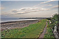
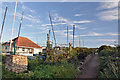
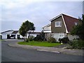
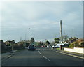
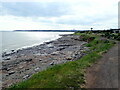
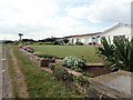

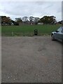
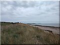
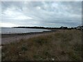
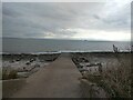
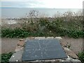
33 photos from this area
Area Information
Key information about the CF64 5SS including its size, population, and administrative classification.
- Area Type
- Postcode
- Area Size
- 8.0 hectares
- Population
- 2235
- Population Density
- 827 people/km²
House Prices in CF64 5SS
61
Properties
£372,675
Average Sold Price
£1,250
Lowest Price
£850,000
Highest Price
Showing 61 properties
| Address | Type | Beds | Baths | Last Sale Price | Last Sale Date | |
|---|---|---|---|---|---|---|
| 32 Smithies Avenue, Sully, CF64 5SS | Bungalow | - | - | £550,000 | Oct 2025 | |
| 35 Smithies Avenue, Sully, CF64 5SS | Bungalow | 3 | 2 | £600,000 | Jul 2025 | |
| 1 Smithies Avenue, Sully, CF64 5SS | Bungalow | 4 | 1 | £550,000 | Sep 2024 | |
| Fair Waters, 21 Smithies Avenue, Sully, CF64 5SS | Retail | 5 | 3 | £850,000 | Aug 2022 | |
| 9 Smithies Avenue, Sully, CF64 5SS | house | - | - | £700,000 | Oct 2021 | |
| 19A Smithies Avenue, Sully, CF64 5SS | house | - | - | £342,500 | Jun 2020 | |
| 24 Smithies Avenue, Sully, CF64 5SS | Bungalow | 4 | 3 | £750,000 | Dec 2019 | |
| 25 Smithies Avenue, Sully, CF64 5SS | Bungalow | 4 | 2 | £415,000 | Sep 2019 | |
| 41 Smithies Avenue, Sully, CF64 5SS | Bungalow | - | - | £455,000 | Sep 2017 | |
| 48 Smithies Avenue, Sully, CF64 5SS | house | - | - | £333,000 | Jul 2017 |
Page 1 of 7
Energy Efficiency in CF64 5SS
Amenities
Schools
| Rank | School | Type | Entry gender | Ages |
|---|
Explore more schools in this area
Go to Schools tabDemographics
Household Size
Two person
most common
Accommodation Type
Houses
most common
Tenure
80
majority
Ethnic Group
White
most common
Religion
N/A
most common
Household Composition
N/A
most common
Age
47
median
Adults (30-64 years)
most common
Household Deprivation
N/A
with no deprivation
NS-SEC
46
in Lower managerial occupations
Explore more demographic insights in this area
Go to Demographics tabPlanning
Planning Constraints
- Flood RiskPremium
- Ramsar Wetland SitesPremium
- Area of Outstanding Natural BeautyPremium
- Protected Nature ReservePremium
- Protected WoodlandPremium
- Crime RiskPremium