Area Overview for CF64 5SN
Photos of CF64 5SN
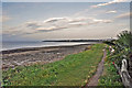
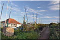
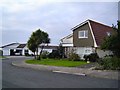
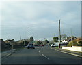
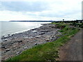
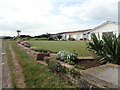

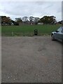
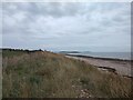
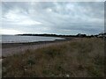
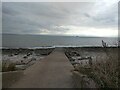
33 photos from this area
Area Information
Key information about the CF64 5SN including its size, population, and administrative classification.
- Area Type
- Postcode
- Area Size
- 1.7 hectares
- Population
- 2235
- Population Density
- 827 people/km²
House Prices in CF64 5SN
23
Properties
£311,996
Average Sold Price
£160,000
Lowest Price
£489,000
Highest Price
Showing 23 properties
| Address | Type | Beds | Baths | Last Sale Price | Last Sale Date | |
|---|---|---|---|---|---|---|
| 118 South Road, Sully, CF64 5SN | Bungalow | 3 | 3 | £440,000 | Apr 2025 | |
| 101 South Road, Sully, CF64 5SN | Detached | - | - | £165,000 | Aug 2021 | |
| 89 South Road, Sully, CF64 5SN | house | - | - | £390,000 | Dec 2019 | |
| 96 South Road, Sully, CF64 5SN | Bungalow | - | - | £489,000 | Sep 2018 | |
| 97 South Road, Sully, CF64 5SN | house | - | - | £390,000 | Jan 2017 | |
| 116 South Road, Sully, CF64 5SN | Bungalow | - | - | £237,000 | Nov 2016 | |
| 95 South Road, Sully, CF64 5SN | Detached | 4 | - | £315,000 | Jan 2015 | |
| 91 South Road, Sully, CF64 5SN | house | - | - | £450,000 | Jul 2012 | |
| 99 South Road, Sully, CF64 5SN | house | 3 | - | £300,000 | Feb 2011 | |
| 112 South Road, Sully, CF64 5SN | Bungalow | - | - | £270,000 | Nov 2010 |
Page 1 of 3
Energy Efficiency in CF64 5SN
Amenities
Schools
| Rank | School | Type | Entry gender | Ages |
|---|
Explore more schools in this area
Go to Schools tabDemographics
Household Size
Two person
most common
Accommodation Type
Houses
most common
Tenure
80
majority
Ethnic Group
White
most common
Religion
N/A
most common
Household Composition
N/A
most common
Age
47
median
Adults (30-64 years)
most common
Household Deprivation
N/A
with no deprivation
NS-SEC
46
in Lower managerial occupations
Explore more demographic insights in this area
Go to Demographics tabPlanning
Planning Constraints
- Flood RiskPremium
- Ramsar Wetland SitesPremium
- Area of Outstanding Natural BeautyPremium
- Protected Nature ReservePremium
- Protected WoodlandPremium
- Crime RiskPremium