Area Overview for NP44 7LG
Photos of NP44 7LG
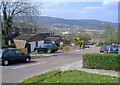
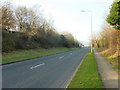
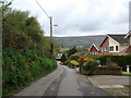
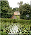
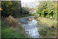
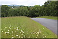
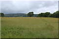
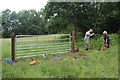
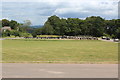
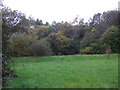
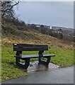
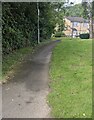
37 photos from this area
Area Information
Key information about the NP44 7LG including its size, population, and administrative classification.
- Area Type
- Postcode
- Area Size
- 9494 m²
- Population
- 1244
- Population Density
- 1307 people/km²
House Prices in NP44 7LG
35
Properties
£106,255
Average Sold Price
£42,500
Lowest Price
£200,000
Highest Price
Showing 35 properties
| Address | Type | Beds | Baths | Last Sale Price | Last Sale Date | |
|---|---|---|---|---|---|---|
| 15 Brynglas, Hollybush, Cwmbran, NP44 7LG | Terraced | 3 | 1 | £200,000 | Apr 2025 | |
| 19 Brynglas, Hollybush, Cwmbran, NP44 7LG | house | - | - | £195,000 | Aug 2023 | |
| 17 Brynglas, Hollybush, Cwmbran, NP44 7LG | Terraced | 3 | 1 | £133,000 | Jun 2017 | |
| 34 Brynglas, Hollybush, Cwmbran, NP44 7LG | Terraced | 3 | 2 | £139,950 | Jun 2017 | |
| 28 Brynglas, Hollybush, Cwmbran, NP44 7LG | Terraced | 3 | - | £125,000 | Nov 2015 | |
| 14 Brynglas, Hollybush, Cwmbran, NP44 7LG | house | - | - | £125,000 | May 2015 | |
| 10 Brynglas, Hollybush, Cwmbran, NP44 7LG | Semi-detached | 4 | - | £125,000 | Jan 2011 | |
| 12 Brynglas, Hollybush, Cwmbran, NP44 7LG | Maisonette | 2 | 1 | £79,950 | Dec 2010 | |
| 16 Brynglas, Hollybush, Cwmbran, NP44 7LG | house | - | - | £94,737 | Aug 2010 | |
| 7 Brynglas, Hollybush, Cwmbran, NP44 7LG | house | - | - | £135,000 | Jul 2007 |
Page 1 of 4
Energy Efficiency in NP44 7LG
Amenities
Schools
| Rank | School | Type | Entry gender | Ages |
|---|
Explore more schools in this area
Go to Schools tabDemographics
Household Size
Two person
most common
Accommodation Type
Houses
most common
Tenure
69
majority
Ethnic Group
White
most common
Religion
N/A
most common
Household Composition
N/A
most common
Age
47
median
Adults (30-64 years)
most common
Household Deprivation
N/A
with no deprivation
NS-SEC
33
in Lower managerial occupations
Explore more demographic insights in this area
Go to Demographics tabPlanning
Planning Constraints
- Flood RiskPremium
- Ramsar Wetland SitesPremium
- Area of Outstanding Natural BeautyPremium
- Protected Nature ReservePremium
- Protected WoodlandPremium
- Crime RiskPremium