Area Overview for NP44 7JF
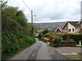
Photos of NP44 7JF


Area Information
Living in NP44 7JF means settling into a specific residential cluster defined by its distinct postcode identity within the Wales postcode system. This small area covers just 6,542 square metres, hosting a community of 1,404 residents. The population density here reaches an extraordinarily high figure of 214,611 people per square kilometre, distinguishing it as a concentrated pocket of habitation. Daily life revolves around this tight-knit population where homes are situated in close proximity to one another. The character of the neighbourhood is shaped by its status as a specific cluster rather than a sprawling suburb. Prospective buyers should note the compact nature of this postcode area, which offers immediate access to local services while maintaining a defined residential boundary. The area serves as a functional part of the wider Cwmbran and Newport region, providing a specific address within a larger urban fabric. For those seeking a very precise location within the NP44 district, this cluster provides a clear and identifiable home environment.
- Area Type
- Postcode
- Area Size
- 6542 m²
- Population
- 1404
- Population Density
- 1425 people/km²
The housing stock of NP44 7JF is defined by a high proportion of owner-occupied properties, with 69 per cent of households owning their homes. This statistic confirms that the area is primarily an owner-occupied zone rather than a rental market, appealing to buyers seeking stability and control over their living environment. The predominant accommodation type consists of houses, which aligns with the needs of the resident population aged 30 to 64 years. Prospective buyers looking for homes in NP44 7JF will find a market skewed towards permanent residents who have invested in their local address. The high density of 214,611 people per square kilometre implies limited land availability, which may influence future development or property extensions. Because the area functions as a specific residential cluster, selling a property here targets a pool of buyers familiar with the NP44 postcode. The lack of flat-style accommodation means that those specifically seeking apartments need to look elsewhere, while house buyers will find a suitable match for their requirements in this cluster.
House Prices in NP44 7JF
Showing 23 properties
| Address | Type | Beds | Baths | Last Sale Price | Last Sale Date | |
|---|---|---|---|---|---|---|
| 135 Trostrey, Hollybush, Cwmbran, NP44 7JF | Semi-detached | - | - | £62,000 | Sep 2002 | |
| 147 Trostrey, Hollybush, Cwmbran, NP44 7JF | Bungalow | - | - | - | - | |
| 151 Trostrey, Hollybush, Cwmbran, NP44 7JF | Bungalow | - | - | - | - | |
| 140 Trostrey, Hollybush, Cwmbran, NP44 7JF | Bungalow | - | - | - | - | |
| 146 Trostrey, Hollybush, Cwmbran, NP44 7JF | Terraced | - | - | - | - | |
| 132 Trostrey, Hollybush, Cwmbran, NP44 7JF | Bungalow | - | - | - | - | |
| 130 Trostrey, Hollybush, Cwmbran, NP44 7JF | Bungalow | - | - | - | - | |
| 136 Trostrey, Hollybush, Cwmbran, NP44 7JF | Bungalow | - | - | - | - | |
| 143 Trostrey, Hollybush, Cwmbran, NP44 7JF | Bungalow | - | - | - | - | |
| 129 Trostrey, Hollybush, Cwmbran, NP44 7JF | Flat | - | - | - | - |
Energy Efficiency in NP44 7JF
Residents of NP44 7JF benefit from immediate access to a range of retail and transport amenities located within practical reach. Five retail outlets serve the local community, including Spar, Asda Cwmbran, and Tesco Cwmbran, ensuring daily shopping requirements are met without lengthy travel. Transport links are equally strong, with five rail stations nearby including Cwmbran Railway Station, Rogerstone Railway Station, and Risca & Pontymister Railway Station. These stations provide straightforward connections for commuters travelling across South Wales. For those wishing to reach the peninsula via water, the Newport Ferry Terminal offers ferry services as a single accessible option for the community. The proximity of Asda Cwmbran and Tesco Cwmbran means groceries and household essentials are available locally, reducing the need to travel far into Newport city centre. This concentration of amenities within easy distance supports a convenient daily routine for the 1,404 people living in this cluster. The availability of multiple train stations provides flexibility in choosing departure points for journeys across the region.
Amenities
Schools
| Rank | School | Type | Entry gender | Ages |
|---|
Explore more schools in this area
Go to Schools tabDemographics
The community of NP44 7JF is characterised by a mature demographic structure centred on adults aged between 30 and 64 years. This age group represents the most common range among the 1,404 residents living in the area. The median age of 47 years indicates a neighbourhood populated primarily by working families and established households rather than young students or retirees. Home ownership stands at 69 per cent, suggesting that the majority of houses in this cluster are owned outright or have a mortgage, reflecting financial stability among residents. The predominant ethnic group is White, mirroring the wider demographic profile of the region. Houses serve as the main form of accommodation, confirming that families and individuals prefer detached or semi-detached properties over flats in this specific postcode. The high home ownership rate combined with the peak age range creates a stable community atmosphere where long-term residents dominate the street frontages. This profile often correlates with strong household income levels and a preference for traditional family housing within the NP44 district.
Household Size
Accommodation Type
Tenure
Ethnic Group
Religion
Household Composition
Age
Household Deprivation
NS-SEC
Explore more demographic insights in this area
Go to Demographics tabPlanning
Planning Constraints
- Flood RiskPremium
- Ramsar Wetland SitesPremium
- Area of Outstanding Natural BeautyPremium
- Protected Nature ReservePremium
- Protected WoodlandPremium
- Crime RiskPremium