Area Overview for NP4 8HG
Photos of NP4 8HG
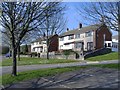
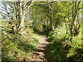
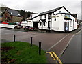
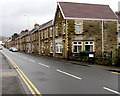

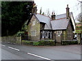
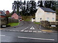


100 photos from this area
Area Information
Key information about the NP4 8HG including its size, population, and administrative classification.
- Area Type
- Postcode
- Area Size
- 1.5 hectares
- Population
- 1792
- Population Density
- 5824 people/km²
House Prices in NP4 8HG
40
Properties
£101,658
Average Sold Price
£57,000
Lowest Price
£151,500
Highest Price
Showing 40 properties
| Address | Type | Beds | Baths | Last Sale Price | Last Sale Date | |
|---|---|---|---|---|---|---|
| 53 Newman Road, Trevethin, Pontypool, NP4 8HG | Terraced | 3 | 1 | £151,500 | Oct 2023 | |
| 65 Newman Road, Trevethin, Pontypool, NP4 8HG | Terraced | 3 | 1 | £139,950 | Dec 2022 | |
| 43 Newman Road, Trevethin, Pontypool, NP4 8HG | house | - | - | £120,000 | Jul 2022 | |
| 54 Newman Road, Trevethin, Pontypool, NP4 8HG | house | - | - | £131,000 | May 2022 | |
| 42 Newman Road, Trevethin, Pontypool, NP4 8HG | Terraced | 3 | 1 | £125,000 | Aug 2021 | |
| 56 Newman Road, Trevethin, Pontypool, NP4 8HG | house | - | - | £79,950 | Oct 2020 | |
| 48 Newman Road, Trevethin, Pontypool, NP4 8HG | Terraced | 3 | 1 | £100,000 | Dec 2018 | |
| 52 Newman Road, Trevethin, Pontypool, NP4 8HG | house | - | - | £58,000 | Aug 2015 | |
| 49 Newman Road, Trevethin, Pontypool, NP4 8HG | house | - | - | £57,000 | Aug 2013 | |
| 44 Newman Road, Trevethin, Pontypool, NP4 8HG | house | - | - | £70,000 | Sep 2010 |
Page 1 of 4
Energy Efficiency in NP4 8HG
Amenities
Schools
| Rank | School | Type | Entry gender | Ages |
|---|
Explore more schools in this area
Go to Schools tabDemographics
Household Size
Family (3-5 people)
most common
Accommodation Type
Houses
most common
Tenure
32
majority
Ethnic Group
White
most common
Religion
N/A
most common
Household Composition
N/A
most common
Age
47
median
Adults (30-64 years)
most common
Household Deprivation
N/A
with no deprivation
NS-SEC
11
in Lower managerial occupations
Explore more demographic insights in this area
Go to Demographics tabPlanning
Planning Constraints
- Flood RiskPremium
- Ramsar Wetland SitesPremium
- Area of Outstanding Natural BeautyPremium
- Protected Nature ReservePremium
- Protected WoodlandPremium
- Crime RiskPremium