Area Overview for NP4 8DY
Photos of NP4 8DY


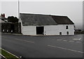
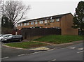
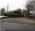
100 photos from this area
Area Information
Key information about the NP4 8DY including its size, population, and administrative classification.
- Area Type
- Postcode
- Area Size
- 1.6 hectares
- Population
- 1792
- Population Density
- 5824 people/km²
House Prices in NP4 8DY
36
Properties
£60,090
Average Sold Price
£13,200
Lowest Price
£135,500
Highest Price
Showing 36 properties
| Address | Type | Beds | Baths | Last Sale Price | Last Sale Date | |
|---|---|---|---|---|---|---|
| 33 Bythway Road, Trevethin, Pontypool, NP4 8DY | Terraced | 3 | 1 | £85,000 | May 2022 | |
| 21 Bythway Road, Trevethin, Pontypool, NP4 8DY | house | - | - | £135,500 | Jan 2022 | |
| 30 Bythway Road, Trevethin, Pontypool, NP4 8DY | Terraced | 3 | - | £88,000 | Nov 2020 | |
| 18 Bythway Road, Trevethin, Pontypool, NP4 8DY | Semi-detached | 3 | - | £85,000 | Sep 2019 | |
| 8 Bythway Road, Trevethin, Pontypool, NP4 8DY | house | 3 | 1 | £94,000 | May 2019 | |
| 29 Bythway Road, Trevethin, Pontypool, NP4 8DY | Terraced | 3 | - | £70,500 | May 2018 | |
| 36 Bythway Road, Trevethin, Pontypool, NP4 8DY | Semi-detached | 3 | 1 | £62,000 | Jun 2017 | |
| 25 Bythway Road, Trevethin, Pontypool, NP4 8DY | Terraced | - | - | £93,000 | Sep 2007 | |
| 12 Bythway Road, Trevethin, Pontypool, NP4 8DY | Terraced | - | - | £17,670 | Dec 2002 | |
| 28 Bythway Road, Trevethin, Pontypool, NP4 8DY | house | - | - | £30,000 | Apr 2002 |
Page 1 of 4
Energy Efficiency in NP4 8DY
Amenities
Schools
| Rank | School | Type | Entry gender | Ages |
|---|
Explore more schools in this area
Go to Schools tabDemographics
Household Size
Family (3-5 people)
most common
Accommodation Type
Houses
most common
Tenure
32
majority
Ethnic Group
White
most common
Religion
N/A
most common
Household Composition
N/A
most common
Age
47
median
Adults (30-64 years)
most common
Household Deprivation
N/A
with no deprivation
NS-SEC
11
in Lower managerial occupations
Explore more demographic insights in this area
Go to Demographics tabPlanning
Planning Constraints
- Flood RiskPremium
- Ramsar Wetland SitesPremium
- Area of Outstanding Natural BeautyPremium
- Protected Nature ReservePremium
- Protected WoodlandPremium
- Crime RiskPremium