Area Overview for NP4 0PS
Photos of NP4 0PS
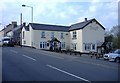


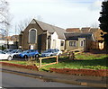

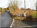

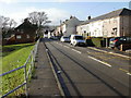


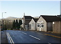
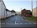
100 photos from this area
Area Information
Key information about the NP4 0PS including its size, population, and administrative classification.
- Area Type
- Postcode
- Area Size
- 7283 m²
- Population
- 1538
- Population Density
- 2849 people/km²
House Prices in NP4 0PS
17
Properties
£151,556
Average Sold Price
£53,000
Lowest Price
£259,000
Highest Price
Showing 17 properties
| Address | Type | Beds | Baths | Last Sale Price | Last Sale Date | |
|---|---|---|---|---|---|---|
| 68 Woodfield Road, New Inn, Pontypool, NP4 0PS | Semi-detached | 3 | 1 | £259,000 | Dec 2023 | |
| 49 Woodfield Road, New Inn, Pontypool, NP4 0PS | Semi-detached | 3 | - | £255,000 | Dec 2022 | |
| Gresford, 59 Woodfield Road, New Inn, Pontypool, NP4 0PS | house | - | - | £170,000 | Dec 2017 | |
| 43 Woodfield Road, New Inn, Pontypool, NP4 0PS | house | - | - | £133,000 | Jul 2016 | |
| 51 Woodfield Road, New Inn, Pontypool, NP4 0PS | Semi-detached | 3 | 1 | £158,000 | Jul 2013 | |
| 69 Woodfield Road, New Inn, Pontypool, NP4 0PS | Semi-detached | 4 | - | £200,000 | Aug 2012 | |
| 63 Woodfield Road, New Inn, Pontypool, NP4 0PS | Semi-detached | - | - | £65,000 | Sep 2005 | |
| 45 Woodfield Road, New Inn, Pontypool, NP4 0PS | Semi-detached | - | - | £71,000 | Nov 2001 | |
| 53 Woodfield Road, New Inn, Pontypool, NP4 0PS | Semi-detached | - | - | £53,000 | Jul 1999 | |
| 65 Woodfield Road, New Inn, Pontypool, NP4 0PS | Semi-detached | - | - | - | - |
Page 1 of 2
Energy Efficiency in NP4 0PS
Amenities
Schools
| Rank | School | Type | Entry gender | Ages |
|---|
Explore more schools in this area
Go to Schools tabDemographics
Household Size
Two person
most common
Accommodation Type
Houses
most common
Tenure
67
majority
Ethnic Group
White
most common
Religion
N/A
most common
Household Composition
N/A
most common
Age
47
median
Adults (30-64 years)
most common
Household Deprivation
N/A
with no deprivation
NS-SEC
31
in Lower managerial occupations
Explore more demographic insights in this area
Go to Demographics tabPlanning
Planning Constraints
- Flood RiskPremium
- Ramsar Wetland SitesPremium
- Area of Outstanding Natural BeautyPremium
- Protected Nature ReservePremium
- Protected WoodlandPremium
- Crime RiskPremium