Area Overview for SA7 9EW
Photos of SA7 9EW
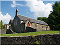
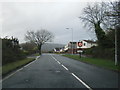
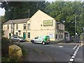
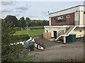
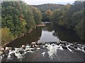
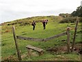
11 photos from this area
Area Information
Key information about the SA7 9EW including its size, population, and administrative classification.
- Area Type
- Postcode
- Area Size
- 2.4 hectares
- Population
- 1453
- Population Density
- 511 people/km²
House Prices in SA7 9EW
23
Properties
£132,416
Average Sold Price
£66,500
Lowest Price
£155,000
Highest Price
Showing 23 properties
| Address | Type | Beds | Baths | Last Sale Price | Last Sale Date | |
|---|---|---|---|---|---|---|
| 8 Oakland Close, Glais, Swansea, SA7 9EW | Semi-detached | 3 | 1 | £155,000 | Nov 2020 | |
| 18 Oakland Close, Glais, Swansea, SA7 9EW | Semi-detached | 3 | 1 | £150,000 | Aug 2017 | |
| 4 Oakland Close, Glais, Swansea, SA7 9EW | house | - | - | £124,995 | Dec 2014 | |
| 14 Oakland Close, Glais, Swansea, SA7 9EW | Semi-detached | 3 | - | £148,000 | Jul 2006 | |
| 21 Oakland Close, Glais, Swansea, SA7 9EW | Detached | - | - | £150,000 | Jul 2003 | |
| 12 Oakland Close, Glais, Swansea, SA7 9EW | Semi-detached | 3 | 1 | £66,500 | Apr 2002 | |
| 9 Oakland Close, Glais, Swansea, SA7 9EW | Detached | - | - | - | - | |
| 5 Oakland Close, Glais, Swansea, SA7 9EW | Detached | - | - | - | - | |
| 15 Oakland Close, Glais, Swansea, SA7 9EW | Detached | - | - | - | - | |
| 20 Oakland Close, Glais, Swansea, SA7 9EW | Detached | - | - | - | - |
Page 1 of 3
Energy Efficiency in SA7 9EW
Amenities
Schools
| Rank | School | Type | Entry gender | Ages |
|---|
Explore more schools in this area
Go to Schools tabDemographics
Household Size
Two person
most common
Accommodation Type
Houses
most common
Tenure
91
majority
Ethnic Group
White
most common
Religion
N/A
most common
Household Composition
N/A
most common
Age
47
median
Adults (30-64 years)
most common
Household Deprivation
N/A
with no deprivation
NS-SEC
38
in Lower managerial occupations
Explore more demographic insights in this area
Go to Demographics tabPlanning
Planning Constraints
- Flood RiskPremium
- Ramsar Wetland SitesPremium
- Area of Outstanding Natural BeautyPremium
- Protected Nature ReservePremium
- Protected WoodlandPremium
- Crime RiskPremium