Area Overview for SA7 9HS
Photos of SA7 9HS
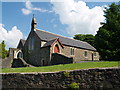
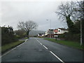
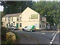
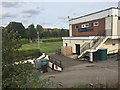
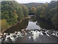
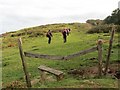
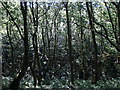
11 photos from this area
Area Information
Key information about the SA7 9HS including its size, population, and administrative classification.
- Area Type
- Postcode
- Area Size
- 14.1 hectares
- Population
- 1396
- Population Density
- 332 people/km²
House Prices in SA7 9HS
50
Properties
£155,457
Average Sold Price
£35,000
Lowest Price
£327,500
Highest Price
Showing 50 properties
| Address | Type | Beds | Baths | Last Sale Price | Last Sale Date | |
|---|---|---|---|---|---|---|
| 54 Graigola Road, Glais, Swansea, SA7 9HS | Semi-detached | 2 | 1 | £160,000 | Nov 2024 | |
| 57 Graigola Road, Glais, Swansea, SA7 9HS | Semi-detached | 3 | 1 | £199,995 | Dec 2023 | |
| 33 Graigola Road, Glais, Swansea, SA7 9HS | Semi-detached | 2 | 1 | £130,000 | Jul 2023 | |
| 64 Graigola Road, Glais, Swansea, SA7 9HS | Terraced | 3 | 1 | £137,500 | Jan 2023 | |
| 5 Graigola Road, Glais, Swansea, SA7 9HS | Detached | 4 | 3 | £260,000 | Jan 2023 | |
| 62 Graigola Road, Glais, Swansea, SA7 9HS | house | - | - | £125,000 | Mar 2022 | |
| 55 Graigola Road, Glais, Swansea, SA7 9HS | house | - | - | £147,000 | Jul 2021 | |
| 44 Graigola Road, Glais, Swansea, SA7 9HS | Detached | 5 | 3 | £327,500 | Apr 2020 | |
| 40 Graigola Road, Glais, Swansea, SA7 9HS | Bungalow | 4 | 3 | £210,000 | Mar 2020 | |
| 36 Graigola Road, Glais, Swansea, SA7 9HS | Bungalow | 4 | 2 | £305,000 | Jul 2019 |
Page 1 of 5
Energy Efficiency in SA7 9HS
Amenities
Schools
| Rank | School | Type | Entry gender | Ages |
|---|
Explore more schools in this area
Go to Schools tabDemographics
Household Size
Two person
most common
Accommodation Type
Houses
most common
Tenure
86
majority
Ethnic Group
White
most common
Religion
N/A
most common
Household Composition
N/A
most common
Age
47
median
Adults (30-64 years)
most common
Household Deprivation
N/A
with no deprivation
NS-SEC
35
in Lower managerial occupations
Explore more demographic insights in this area
Go to Demographics tabPlanning
Planning Constraints
- Flood RiskPremium
- Ramsar Wetland SitesPremium
- Area of Outstanding Natural BeautyPremium
- Protected Nature ReservePremium
- Protected WoodlandPremium
- Crime RiskPremium