Area Overview for SA6 6QG
Photos of SA6 6QG
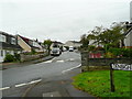


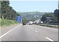


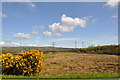
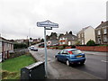
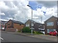

11 photos from this area
Area Information
Key information about the SA6 6QG including its size, population, and administrative classification.
- Area Type
- Postcode
- Area Size
- 2.2 hectares
- Population
- 1397
- Population Density
- 2931 people/km²
House Prices in SA6 6QG
26
Properties
£162,023
Average Sold Price
£112,000
Lowest Price
£272,500
Highest Price
Showing 26 properties
| Address | Type | Beds | Baths | Last Sale Price | Last Sale Date | |
|---|---|---|---|---|---|---|
| 38 Heol Glan Nant, Ynysforgan, Swansea, SA6 6QG | Semi-detached | 4 | 3 | £272,500 | May 2022 | |
| 37 Heol Glan Nant, Ynysforgan, Swansea, SA6 6QG | Semi-detached | 3 | 1 | £147,000 | Dec 2019 | |
| 46 Heol Glan Nant, Ynysforgan, Swansea, SA6 6QG | house | - | - | £123,000 | Aug 2011 | |
| 33 Heol Glan Nant, Ynysforgan, Swansea, SA6 6QG | house | 3 | - | £112,000 | May 2011 | |
| 21 Heol Glan Nant, Ynysforgan, Swansea, SA6 6QG | Semi-detached | - | - | £152,635 | May 2008 | |
| 25 Heol Glan Nant, Ynysforgan, Swansea, SA6 6QG | Semi-detached | - | - | £165,000 | Aug 2007 | |
| 23 Heol Glan Nant, Ynysforgan, Swansea, SA6 6QG | Semi-detached | - | - | - | - | |
| 30 Heol Glan Nant, Ynysforgan, Swansea, SA6 6QG | Semi-detached | - | - | - | - | |
| 35 Heol Glan Nant, Ynysforgan, Swansea, SA6 6QG | Semi-detached | - | - | - | - | |
| 17 Heol Glan Nant, Ynysforgan, Swansea, SA6 6QG | Semi-detached | - | - | - | - |
Page 1 of 3
Energy Efficiency in SA6 6QG
Amenities
Schools
| Rank | School | Type | Entry gender | Ages |
|---|
Explore more schools in this area
Go to Schools tabDemographics
Household Size
Two person
most common
Accommodation Type
Houses
most common
Tenure
75
majority
Ethnic Group
White
most common
Religion
N/A
most common
Household Composition
N/A
most common
Age
47
median
Adults (30-64 years)
most common
Household Deprivation
N/A
with no deprivation
NS-SEC
30
in Lower managerial occupations
Explore more demographic insights in this area
Go to Demographics tabPlanning
Planning Constraints
- Flood RiskPremium
- Ramsar Wetland SitesPremium
- Area of Outstanding Natural BeautyPremium
- Protected Nature ReservePremium
- Protected WoodlandPremium
- Crime RiskPremium