Area Overview for SA6 6NQ
Photos of SA6 6NQ
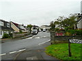


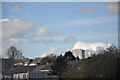
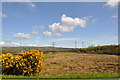
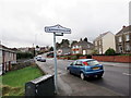
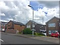
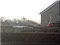
11 photos from this area
Area Information
Key information about the SA6 6NQ including its size, population, and administrative classification.
- Area Type
- Postcode
- Area Size
- 3.0 hectares
- Population
- 1292
- Population Density
- 3404 people/km²
House Prices in SA6 6NQ
32
Properties
£102,568
Average Sold Price
£42,500
Lowest Price
£200,000
Highest Price
Showing 32 properties
| Address | Type | Beds | Baths | Last Sale Price | Last Sale Date | |
|---|---|---|---|---|---|---|
| 55 Rhodfa Fadog, Cwmrhydyceirw, Swansea, SA6 6NQ | Detached | 3 | 1 | £170,000 | Jul 2021 | |
| 41 Rhodfa Fadog, Cwmrhydyceirw, Swansea, SA6 6NQ | house | - | - | £135,000 | Jun 2020 | |
| 61 Rhodfa Fadog, Cwmrhydyceirw, Swansea, SA6 6NQ | house | 4 | 1 | £184,000 | May 2015 | |
| 64 Rhodfa Fadog, Cwmrhydyceirw, Swansea, SA6 6NQ | house | - | - | £200,000 | Sep 2014 | |
| 46 Rhodfa Fadog, Cwmrhydyceirw, Swansea, SA6 6NQ | Detached | 5 | 3 | £167,500 | Dec 2008 | |
| 45 Rhodfa Fadog, Cwmrhydyceirw, Swansea, SA6 6NQ | Semi-detached | - | - | £85,000 | Nov 2005 | |
| 49 Rhodfa Fadog, Cwmrhydyceirw, Swansea, SA6 6NQ | Terraced | - | - | £83,500 | Jan 2003 | |
| 52 Rhodfa Fadog, Cwmrhydyceirw, Swansea, SA6 6NQ | Semi-detached | - | - | £42,500 | Dec 2002 | |
| 56 Rhodfa Fadog, Cwmrhydyceirw, Swansea, SA6 6NQ | Semi-detached | - | - | £61,000 | Jun 2001 | |
| 50 Rhodfa Fadog, Cwmrhydyceirw, Swansea, SA6 6NQ | Semi-detached | - | - | £59,950 | Jul 2000 |
Page 1 of 4
Energy Efficiency in SA6 6NQ
Amenities
Schools
| Rank | School | Type | Entry gender | Ages |
|---|
Explore more schools in this area
Go to Schools tabDemographics
Household Size
Two person
most common
Accommodation Type
Houses
most common
Tenure
89
majority
Ethnic Group
White
most common
Religion
N/A
most common
Household Composition
N/A
most common
Age
47
median
Adults (30-64 years)
most common
Household Deprivation
N/A
with no deprivation
NS-SEC
37
in Lower managerial occupations
Explore more demographic insights in this area
Go to Demographics tabPlanning
Planning Constraints
- Flood RiskPremium
- Ramsar Wetland SitesPremium
- Area of Outstanding Natural BeautyPremium
- Protected Nature ReservePremium
- Protected WoodlandPremium
- Crime RiskPremium