Area Overview for SA2 7EA
Photos of SA2 7EA
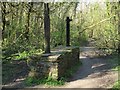
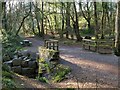
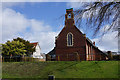
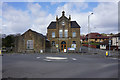
60 photos from this area
Area Information
Key information about the SA2 7EA including its size, population, and administrative classification.
- Area Type
- Postcode
- Area Size
- 1.1 hectares
- Population
- 2238
- Population Density
- 895 people/km²
House Prices in SA2 7EA
18
Properties
£207,855
Average Sold Price
£54,000
Lowest Price
£320,000
Highest Price
Showing 18 properties
| Address | Type | Beds | Baths | Last Sale Price | Last Sale Date | |
|---|---|---|---|---|---|---|
| 12 Clyne View, Killay, Swansea, SA2 7EA | Semi-detached | 2 | 1 | £320,000 | Dec 2025 | |
| 16 Clyne View, Killay, Swansea, SA2 7EA | Bungalow | - | - | £285,000 | Sep 2024 | |
| 14 Clyne View, Killay, Swansea, SA2 7EA | Semi-detached | 2 | 1 | £290,000 | Feb 2024 | |
| 19 Clyne View, Killay, Swansea, SA2 7EA | house | - | - | £315,000 | Oct 2023 | |
| 11 Clyne View, Killay, Swansea, SA2 7EA | Bungalow | - | - | £286,250 | Apr 2021 | |
| 7 Clyne View, Killay, Swansea, SA2 7EA | Bungalow | - | - | £160,000 | Jul 2018 | |
| 15 Clyne View, Killay, Swansea, SA2 7EA | Semi-detached | 2 | 1 | £210,000 | Jun 2015 | |
| 3 Clyne View, Killay, Swansea, SA2 7EA | Bungalow | - | - | £195,000 | Oct 2012 | |
| 6 Clyne View, Killay, Swansea, SA2 7EA | Semi-detached | 2 | 1 | £165,010 | Feb 2011 | |
| 18 Clyne View, Killay, Swansea, SA2 7EA | Detached | 2 | 1 | £150,000 | Jul 2003 |
Page 1 of 2
Energy Efficiency in SA2 7EA
Amenities
Schools
| Rank | School | Type | Entry gender | Ages |
|---|
Explore more schools in this area
Go to Schools tabDemographics
Household Size
Two person
most common
Accommodation Type
Houses
most common
Tenure
76
majority
Ethnic Group
White
most common
Religion
N/A
most common
Household Composition
N/A
most common
Age
47
median
Adults (30-64 years)
most common
Household Deprivation
N/A
with no deprivation
NS-SEC
32
in Lower managerial occupations
Explore more demographic insights in this area
Go to Demographics tabPlanning
Planning Constraints
- Flood RiskPremium
- Ramsar Wetland SitesPremium
- Area of Outstanding Natural BeautyPremium
- Protected Nature ReservePremium
- Protected WoodlandPremium
- Crime RiskPremium