Area Overview for SA2 7AL
Photos of SA2 7AL
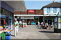
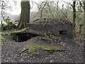
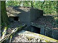
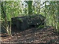
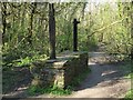
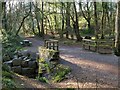
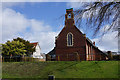
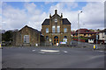
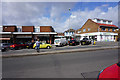
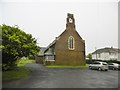
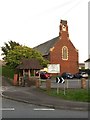
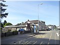
60 photos from this area
Area Information
Key information about the SA2 7AL including its size, population, and administrative classification.
- Area Type
- Postcode
- Area Size
- 5104 m²
- Population
- 2238
- Population Density
- 895 people/km²
House Prices in SA2 7AL
10
Properties
£202,500
Average Sold Price
£165,000
Lowest Price
£240,000
Highest Price
Showing 10 properties
| Address | Type | Beds | Baths | Last Sale Price | Last Sale Date | |
|---|---|---|---|---|---|---|
| Flat, 448 Gower Road, Killay, Swansea, SA2 7AL | Flat | - | - | £165,000 | Aug 2021 | |
| 458A Gower Road, Killay, Swansea, SA2 7AL | Flat | - | - | £240,000 | Jan 2006 | |
| Flat, 450 Gower Road, Killay, Swansea, SA2 7AL | Retail | - | - | - | - | |
| Waterside Laundry, 446 Gower Road, Killay, Swansea, SA2 7AL | Retail | - | - | - | - | |
| Hair Zone, 454 Gower Road, Killay, Swansea, SA2 7AL | shop | - | - | - | - | |
| First Floor, 454 Gower Road, Killay, Swansea, SA2 7AL | office_workshop | - | - | - | - | |
| Flat, 452 Gower Road, Killay, Swansea, SA2 7AL | Flat | 2 | 1 | - | - | |
| Gorgeous Nails And Beauty, Rear Of, 458 Gower Road, Killay, Swansea, SA2 7AL | Office | - | - | - | - | |
| Stephen Kent & Company, 456 Gower Road, Killay, Swansea, SA2 7AL | office_workshop | - | - | - | - | |
| 452 Gower Road, Celtic Vapours, Killay, Swansea, SA2 7AL | Retail | - | - | - | - |
Energy Efficiency in SA2 7AL
Amenities
Schools
| Rank | School | Type | Entry gender | Ages |
|---|
Explore more schools in this area
Go to Schools tabDemographics
Household Size
Two person
most common
Accommodation Type
Houses
most common
Tenure
76
majority
Ethnic Group
White
most common
Religion
N/A
most common
Household Composition
N/A
most common
Age
47
median
Adults (30-64 years)
most common
Household Deprivation
N/A
with no deprivation
NS-SEC
32
in Lower managerial occupations
Explore more demographic insights in this area
Go to Demographics tabPlanning
Planning Constraints
- Flood RiskPremium
- Ramsar Wetland SitesPremium
- Area of Outstanding Natural BeautyPremium
- Protected Nature ReservePremium
- Protected WoodlandPremium
- Crime RiskPremium