Area Overview for CF45 4UQ
Photos of CF45 4UQ
Area Information
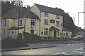
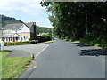
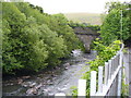
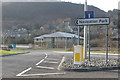
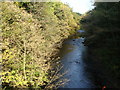
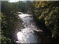
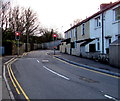
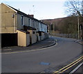
CF45 4UQ is a small residential cluster in the Cynon Valley, Wales, encompassing the village of Abercynon and surrounding districts like Carnetown and Glancynon. The area sits at the confluence of the River Cynon and River Taff, historically significant as the site of the world’s first steam railway journey in 1804. Today, it is a quiet, low-density community with 1,488 residents spread over 3.2 hectares, resulting in a population density of 365 people per square kilometre. The village retains its industrial heritage, with landmarks such as the Navigation Hotel and memorials to the 1804 railway feat. Daily life here is shaped by its compact size and proximity to transport networks. While modern amenities are limited, the area’s charm lies in its historical roots and the presence of community hubs like the Workmen’s Hall. Residents benefit from nearby railway stations and local shops, though the area’s character remains defined by its rural setting and historical significance rather than urban sprawl.
- Area Type
- Postcode
- Area Size
- 3.2 hectares
- Population
- 1488
- Population Density
- 365 people/km²
The property market in CF45 4UQ is characterised by a high rate of home ownership (78%) and a predominance of houses over flats or other accommodation types. This reflects a community where property is largely owner-occupied, with limited rental activity. Given the area’s small size (3.2 hectares) and modest population, the housing stock is constrained, likely comprising a mix of older homes and smaller detached properties. The focus on houses rather than apartments suggests a preference for private, low-density living. For buyers, this means a limited inventory of properties, potentially leading to competition among local residents. The area’s historical and rural nature may appeal to those seeking a quieter lifestyle, though the lack of large commercial or industrial employers could limit long-term property value growth. Prospective buyers should consider the compact size of the area and its proximity to transport links as key factors in their decision-making.
House Prices in CF45 4UQ
Showing 3 properties
| Address | Type | Beds | Baths | Last Sale Price | Last Sale Date | |
|---|---|---|---|---|---|---|
| Cwm Taf University Health Board, Ty Trevithick, Cilfynydd Road, Abercynon, CF45 4UQ | commercial | - | - | - | - | |
| Ty Trevithick, Cilfynydd Road, Abercynon, CF45 4UQ | office_workshop | - | - | - | - | |
| South Wales Police And Crime Commissioner, Ty Trevithick, Cilfynydd Road, Abercynon, CF45 4UQ | commercial | - | - | - | - |
Energy Efficiency in CF45 4UQ
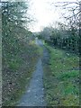
The lifestyle in CF45 4UQ is shaped by its small-scale amenities and historical character. Nearby retail options include Co-op Treharris and Spar Certas, providing essential shopping for residents. The area’s railway stations offer access to broader transport networks, though the village itself lacks large commercial centres or leisure facilities. The presence of local shops and the historical significance of sites like the Navigation Hotel contribute to a community feel rooted in tradition. While parks or recreational areas are not explicitly mentioned, the area’s proximity to rivers and historical sites suggests opportunities for walking or heritage tourism. The compact nature of the area means that daily life revolves around local services and the village’s historical landmarks, creating a self-contained but modest lifestyle.
Amenities
Schools
The nearest school to CF45 4UQ is Carnetown Primary School, which is categorised as an "other" type in the data. While no Ofsted rating is provided, the presence of a primary school indicates that the area supports local education needs for younger children. The absence of secondary schools or further education institutions in the immediate vicinity may require families to travel to nearby towns for higher-level schooling. The school’s type and lack of detailed performance data suggest a focus on basic education, which could be adequate for families prioritising proximity to their homes. However, the limited range of educational facilities may be a consideration for those requiring a broader spectrum of schooling options.
| Rank | School | Type | Entry gender | Ages |
|---|
Explore more schools in this area
Go to Schools tabDemographics
The population of CF45 4UQ is 1,488, with a median age of 47, indicating a community skewed toward middle-aged and older adults. The most common age range is 30–64 years, suggesting a stable, established population rather than a transient one. Home ownership is high at 78%, with the predominant accommodation type being houses. This reflects a residential area where long-term occupancy is common. The predominant ethnic group is White, with no data provided on other demographics. The population density of 365 people per square kilometre is moderate for a rural area, balancing seclusion with accessibility to nearby services. The age profile and home ownership rates suggest a community focused on stability, with limited reliance on rental housing. This demographic structure may influence local services, with amenities tailored to adult needs rather than those of children or younger families.
Household Size
Accommodation Type
Tenure
Ethnic Group
Religion
Household Composition
Age
Household Deprivation
NS-SEC
Explore more demographic insights in this area
Go to Demographics tabPlanning
Planning Constraints
- Flood RiskPremium
- Ramsar Wetland SitesPremium
- Area of Outstanding Natural BeautyPremium
- Protected Nature ReservePremium
- Protected WoodlandPremium
- Crime RiskPremium