Area Overview for CF45 4XQ
Photos of CF45 4XQ
Area Information
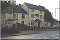
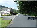
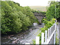
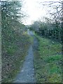
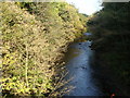
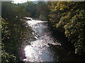
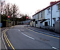
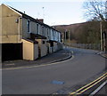
CF45 4XQ is a small residential cluster in the Cynon Valley, Wales, with a population of 1,488 people spread over 4.08 km². This area, known as Abercynon, sits at the confluence of the River Cynon and River Taff, a historic spot linked to the world’s first steam railway journey in 1804. The village blends quiet residential living with a rich industrial heritage, marked by canals, railways, and 19th-century chapels. Daily life here is shaped by proximity to rail networks, with five stations within reach, including Abercynon and Penrhiwceiber. The community is predominantly middle-aged, with a median age of 47, and 78% of homes are owner-occupied. Local amenities include retail outlets like Co-op Treharris and Spar Certas, while historical sites such as the Navigation Hotel and a 1925 shrine on the River Taff add character. Living here offers a mix of tranquillity and accessibility, with transport links to nearby towns and a distinct sense of local history.
- Area Type
- Postcode
- Area Size
- Not available
- Population
- 1488
- Population Density
- 365 people/km²
CF45 4XQ is predominantly an owner-occupied area, with 78% of homes owned by residents rather than rented. The accommodation type is primarily houses, which is typical for smaller, rural clusters where larger properties dominate. This suggests a market skewed towards established homeowners seeking stability, with limited rental availability. Given the area’s small size, property choices are constrained, and buyers should consider proximity to nearby towns for broader options. The predominance of houses may appeal to those prioritising space and privacy, though the lack of commercial or industrial development means the area is not a hub for investment or speculative buying.
House Prices in CF45 4XQ
No properties found in this postcode.
Energy Efficiency in CF45 4XQ
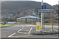
The lifestyle in CF45 4XQ is defined by proximity to rail stations, retail outlets, and historical sites. Five rail stations, including Abercynon and Quakers Yard, offer easy access to regional transport, while nearby shops like Co-op Treharris and Spar Certas cater to daily needs. The area’s heritage is evident in landmarks such as the Navigation Hotel and a 1925 shrine on the River Taff, blending history with local identity. Though parks or leisure facilities are not explicitly listed, the village’s compact size ensures amenities are within walking distance, fostering a sense of community and convenience.
Amenities
Schools
The nearest school to CF45 4XQ is Carnetown Primary School, categorised as an ‘other’ type in the data. No Ofsted ratings or additional details about the school’s performance are provided. Families relying on this school would need to consider its capacity and whether it meets their child’s educational needs. The absence of secondary schools or other educational institutions in the immediate area means parents may need to look beyond CF45 4XQ for comprehensive schooling options.
| Rank | School | Type | Entry gender | Ages |
|---|
Explore more schools in this area
Go to Schools tabDemographics
The population of CF45 4XQ is 1,488 people, with a median age of 47 and the majority (30–64 years) in middle adulthood. Home ownership is high at 78%, indicating a stable, long-term resident base. Most properties are houses, reflecting a preference for single-family dwellings. The predominant ethnic group is White, though no further diversity data is provided. This age profile suggests a community of established families and professionals, with fewer younger residents or retirees. The absence of specific deprivation data means quality of life factors like healthcare access or social services are not quantified here, but the high home ownership rate and age range imply a cohesive, mature demographic.
Household Size
Accommodation Type
Tenure
Ethnic Group
Religion
Household Composition
Age
Household Deprivation
NS-SEC
Explore more demographic insights in this area
Go to Demographics tabPlanning
Planning Constraints
- Flood RiskPremium
- Ramsar Wetland SitesPremium
- Area of Outstanding Natural BeautyPremium
- Protected Nature ReservePremium
- Protected WoodlandPremium
- Crime RiskPremium