Area Overview for CF42 5SU
Photos of CF42 5SU
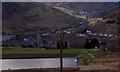
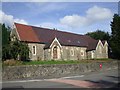
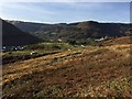
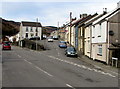
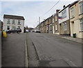
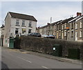
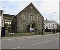
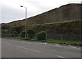
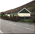
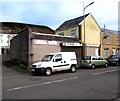
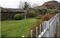

24 photos from this area
Area Information
Key information about the CF42 5SU including its size, population, and administrative classification.
- Area Type
- Postcode
- Area Size
- 1.0 hectares
- Population
- 1311
- Population Density
- 519 people/km²
House Prices in CF42 5SU
59
Properties
£63,447
Average Sold Price
£5,750
Lowest Price
£160,000
Highest Price
Showing 59 properties
| Address | Type | Beds | Baths | Last Sale Price | Last Sale Date | |
|---|---|---|---|---|---|---|
| 50 Halifax Terrace, Tynewydd, Treherbert, CF42 5SU | Terraced | 2 | 1 | £79,500 | Aug 2025 | |
| 20 Halifax Terrace, Tynewydd, Treherbert, CF42 5SU | Terraced | 3 | 1 | £104,000 | Mar 2025 | |
| 38 Halifax Terrace, Tynewydd, Treherbert, CF42 5SU | Terraced | 3 | 1 | £125,000 | May 2024 | |
| 55 Halifax Terrace, Tynewydd, Treherbert, CF42 5SU | Terraced | 2 | - | £50,500 | Feb 2024 | |
| 23 Halifax Terrace, Tynewydd, Treherbert, CF42 5SU | Terraced | 3 | 1 | £64,500 | Dec 2023 | |
| 25 Halifax Terrace, Tynewydd, Treherbert, CF42 5SU | Terraced | 3 | 1 | £87,000 | Nov 2023 | |
| 39 Halifax Terrace, Tynewydd, Treherbert, CF42 5SU | house | 3 | 1 | £135,000 | Sep 2023 | |
| 47 Halifax Terrace, Tynewydd, Treherbert, CF42 5SU | Terraced | 3 | 1 | £86,000 | Dec 2022 | |
| 34 Halifax Terrace, Tynewydd, Treherbert, CF42 5SU | Terraced | 2 | 1 | £76,000 | Sep 2022 | |
| 15 Halifax Terrace, Tynewydd, Treherbert, CF42 5SU | Retail | 5 | 3 | £160,000 | May 2022 |
Page 1 of 6
Energy Efficiency in CF42 5SU
Amenities
Schools
| Rank | School | Type | Entry gender | Ages |
|---|
Explore more schools in this area
Go to Schools tabDemographics
Household Size
One person
most common
Accommodation Type
Houses
most common
Tenure
69
majority
Ethnic Group
White
most common
Religion
N/A
most common
Household Composition
N/A
most common
Age
47
median
Adults (30-64 years)
most common
Household Deprivation
N/A
with no deprivation
NS-SEC
19
in Lower managerial occupations
Explore more demographic insights in this area
Go to Demographics tabPlanning
Planning Constraints
- Flood RiskPremium
- Ramsar Wetland SitesPremium
- Area of Outstanding Natural BeautyPremium
- Protected Nature ReservePremium
- Protected WoodlandPremium
- Crime RiskPremium