Area Overview for CF42 5SP
Photos of CF42 5SP

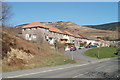
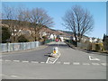
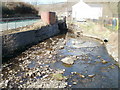
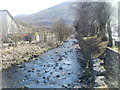
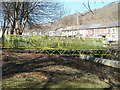
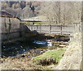
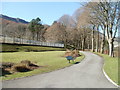

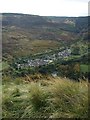
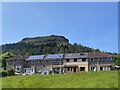
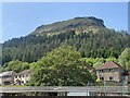
67 photos from this area
Area Information
Key information about the CF42 5SP including its size, population, and administrative classification.
- Area Type
- Postcode
- Area Size
- 4.9 hectares
- Population
- 1484
- Population Density
- 109 people/km²
House Prices in CF42 5SP
40
Properties
£97,966
Average Sold Price
£32,000
Lowest Price
£270,000
Highest Price
Showing 40 properties
| Address | Type | Beds | Baths | Last Sale Price | Last Sale Date | |
|---|---|---|---|---|---|---|
| 39 Blaenrhondda Road, Blaenrhondda, CF42 5SP | Terraced | 2 | 1 | £118,500 | Dec 2025 | |
| 12 Blaenrhondda Road, Blaenrhondda, CF42 5SP | Terraced | 6 | 3 | £270,000 | Mar 2025 | |
| 31 Blaenrhondda Road, Blaenrhondda, CF42 5SP | Terraced | 3 | 2 | £108,000 | May 2024 | |
| 11 Blaenrhondda Road, Blaenrhondda, CF42 5SP | Semi-detached | 3 | - | £80,000 | Apr 2024 | |
| 36 Blaenrhondda Road, Blaenrhondda, CF42 5SP | Semi-detached | 4 | 3 | £205,000 | May 2023 | |
| 18 Blaenrhondda Road, Blaenrhondda, CF42 5SP | Terraced | 3 | 1 | £127,950 | Apr 2023 | |
| 21 Blaenrhondda Road, Blaenrhondda, CF42 5SP | Semi-detached | 4 | 1 | £96,500 | Sep 2019 | |
| 26 Blaenrhondda Road, Blaenrhondda, CF42 5SP | Terraced | 3 | 1 | £112,000 | Aug 2019 | |
| 27 Blaenrhondda Road, Blaenrhondda, CF42 5SP | house | 3 | 1 | £74,000 | Aug 2018 | |
| 6 Blaenrhondda Road, Blaenrhondda, CF42 5SP | Semi-detached | 3 | 2 | £37,000 | Feb 2015 |
Page 1 of 4
Energy Efficiency in CF42 5SP
Amenities
Schools
| Rank | School | Type | Entry gender | Ages |
|---|
Explore more schools in this area
Go to Schools tabDemographics
Household Size
One person
most common
Accommodation Type
Houses
most common
Tenure
67
majority
Ethnic Group
White
most common
Religion
N/A
most common
Household Composition
N/A
most common
Age
47
median
Adults (30-64 years)
most common
Household Deprivation
N/A
with no deprivation
NS-SEC
19
in Lower managerial occupations
Explore more demographic insights in this area
Go to Demographics tabPlanning
Planning Constraints
- Flood RiskPremium
- Ramsar Wetland SitesPremium
- Area of Outstanding Natural BeautyPremium
- Protected Nature ReservePremium
- Protected WoodlandPremium
- Crime RiskPremium