Area Overview for SA9 2XR
Photos of SA9 2XR
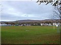
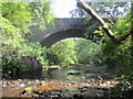
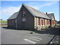

25 photos from this area
Area Information
Key information about the SA9 2XR including its size, population, and administrative classification.
- Area Type
- Postcode
- Area Size
- 6.4 hectares
- Population
- 2219
- Population Density
- 170 people/km²
House Prices in SA9 2XR
12
Properties
£77,967
Average Sold Price
£37,000
Lowest Price
£105,000
Highest Price
Showing 12 properties
| Address | Type | Beds | Baths | Last Sale Price | Last Sale Date | |
|---|---|---|---|---|---|---|
| 2 Felinfach, Ystradowen, Swansea, SA9 2XR | Cottage | 2 | 1 | £105,000 | Apr 2025 | |
| 8 Felinfach, Ystradowen, Swansea, SA9 2XR | Terraced | 2 | 1 | £80,000 | Nov 2017 | |
| 14 Felinfach, Ystradowen, Swansea, SA9 2XR | Terraced | 2 | 1 | £95,000 | Sep 2017 | |
| 6 Felinfach, Ystradowen, Swansea, SA9 2XR | house | 3 | - | £105,000 | Oct 2013 | |
| Ty Felinfach, Felinfach, Ystradowen, Swansea, SA9 2XR | Detached | - | - | £45,800 | Dec 2008 | |
| 12 Felinfach, Ystradowen, Swansea, SA9 2XR | Cottage | 3 | 1 | £37,000 | Mar 2003 | |
| Plas Y Coed, Felinfach, Ystradowen, Swansea, SA9 2XR | Detached | 4 | 2 | - | - | |
| 4 Felinfach, Ystradowen, Swansea, SA9 2XR | house | - | - | - | - | |
| Annexe, Ty Felinfach, Felinfach, Ystradowen, Swansea, SA9 2XR | Detached | - | - | - | - | |
| Swn Yr Afon, Felinfach, Ystradowen, Swansea, SA9 2XR | Detached | - | - | - | - |
Page 1 of 2
Energy Efficiency in SA9 2XR
Amenities
Schools
| Rank | School | Type | Entry gender | Ages |
|---|
Explore more schools in this area
Go to Schools tabDemographics
Household Size
Family (3-5 people)
most common
Accommodation Type
Houses
most common
Tenure
66
majority
Ethnic Group
White
most common
Religion
N/A
most common
Household Composition
N/A
most common
Age
47
median
Adults (30-64 years)
most common
Household Deprivation
N/A
with no deprivation
NS-SEC
27
in Lower managerial occupations
Explore more demographic insights in this area
Go to Demographics tabPlanning
Planning Constraints
- Flood RiskPremium
- Ramsar Wetland SitesPremium
- Area of Outstanding Natural BeautyPremium
- Protected Nature ReservePremium
- Protected WoodlandPremium
- Crime RiskPremium