Area Overview for SA9 2YP
Photos of SA9 2YP
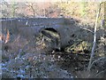
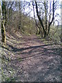
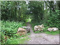
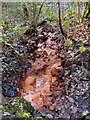
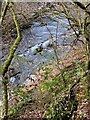
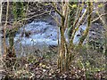
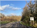
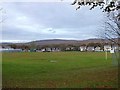
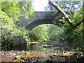
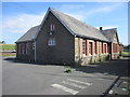

25 photos from this area
Area Information
Key information about the SA9 2YP including its size, population, and administrative classification.
- Area Type
- Postcode
- Area Size
- 8.4 hectares
- Population
- 1450
- Population Density
- 47 people/km²
House Prices in SA9 2YP
19
Properties
£131,875
Average Sold Price
£34,000
Lowest Price
£247,000
Highest Price
Showing 19 properties
| Address | Type | Beds | Baths | Last Sale Price | Last Sale Date | |
|---|---|---|---|---|---|---|
| 17 Penygraig Road, Ystradowen, Swansea, SA9 2YP | Detached | 4 | 2 | £247,000 | Aug 2024 | |
| 11 Penygraig Road, Ystradowen, Swansea, SA9 2YP | Bungalow | - | - | £200,000 | Jun 2024 | |
| 15 Penygraig Road, Ystradowen, Swansea, SA9 2YP | Detached | 4 | 1 | £192,500 | Dec 2019 | |
| 37 Penygraig Road, Ystradowen, Swansea, SA9 2YP | Detached | 2 | 1 | £161,000 | Feb 2019 | |
| 33 Penygraig Road, Ystradowen, Swansea, SA9 2YP | Detached | 3 | 1 | £188,000 | Nov 2013 | |
| 21 Penygraig Road, Ystradowen, Swansea, SA9 2YP | Bungalow | 2 | 1 | £90,000 | Jun 2013 | |
| 52 Penygraig Road, Ystradowen, Swansea, SA9 2YP | Semi-detached | - | - | £139,000 | May 2008 | |
| 13 Penygraig Road, Ystradowen, Swansea, SA9 2YP | Detached | - | - | £105,050 | Apr 2008 | |
| 31 Penygraig Road, Ystradowen, Swansea, SA9 2YP | Terraced | - | - | £70,000 | Aug 2006 | |
| 25 Penygraig Road, Ystradowen, Swansea, SA9 2YP | Detached | - | - | £79,950 | Jan 2003 |
Page 1 of 2
Energy Efficiency in SA9 2YP
Amenities
Schools
| Rank | School | Type | Entry gender | Ages |
|---|
Explore more schools in this area
Go to Schools tabDemographics
Household Size
Two person
most common
Accommodation Type
Houses
most common
Tenure
80
majority
Ethnic Group
White
most common
Religion
N/A
most common
Household Composition
N/A
most common
Age
47
median
Adults (30-64 years)
most common
Household Deprivation
N/A
with no deprivation
NS-SEC
29
in Lower managerial occupations
Explore more demographic insights in this area
Go to Demographics tabPlanning
Planning Constraints
- Flood RiskPremium
- Ramsar Wetland SitesPremium
- Area of Outstanding Natural BeautyPremium
- Protected Nature ReservePremium
- Protected WoodlandPremium
- Crime RiskPremium