Area Overview for NP8 1RH
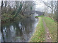
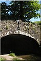
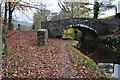
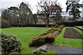
Photos of NP8 1RH
Area Information
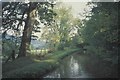
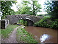
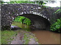
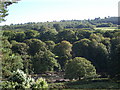
Living in NP8 1RH offers a defined residential experience within a spacious postcodes covering a small cluster of homes in Wales. This specific area spans 12.0 hectares and supports a population of 2,149 people. The layout creates a distinctively low-density environment where the built environment does not dominate the landscape. Residents here enjoy a slower pace of life compared to larger urban centres, beneficial for those seeking quiet surroundings. The physical size of the postcode area relative to its population results in significant open space between properties. This spatial arrangement shapes daily routines, often requiring reliance on local amenities or vehicles for further travel. The area represents a traditional residential zone rather than a commercial hub. Neighbourhood life revolves around the local council estate rather than a vibrant town centre. Prospective buyers should understand that life here is defined by its rural character and limited density. The area functions as a self-contained community unit within the wider Welsh property market. Understanding the scale of 12.0 hectares helps frame expectations about noise levels and immediate surroundings for anyone considering this location.
- Area Type
- Postcode
- Area Size
- 12.0 hectares
- Population
- 2149
- Population Density
- 16 people/km²
The property market in NP8 1RH is characterised by a strong preference for single-family homes and private ownership. Seventy-seven per cent of households own their homes, creating a stable, owner-occupied market rather than a volatile rental sector. Properties here are exclusively houses, eliminating the option of flats or terraced accommodation available in denser urban postcodes. This housing stock suits buyers seeking standalone gardens and independent living spaces. The low population density of 16 people per square kilometre supports a housing model built on green space rather than shared walls. Current market activity reflects the needs of families and established individuals rather than investors seeking high-yield rentals. Buyers should note that the variety of property types is limited to detached or semi-detached houses due to the area's development constraints. This lack of diversity means competition often focuses on property condition and size rather than building style or proximity to amusement venues. The high home ownership rate also suggests that relocation is less frequent, potentially limiting the frequency of sales even in an active market. Understanding these dynamics helps you make informed decisions when househunting in NP8 1RH.
House Prices in NP8 1RH
Showing 5 properties
Energy Efficiency in NP8 1RH
Your daily lifestyle in NP8 1RH relies heavily on a selection of retail venues accessible within practical commuting distance. The nearest retail options include the Co-op Crickhowell which serves as a primary grocery destination. Shoppers also access the Lidl Brynmawr for lower-cost food and household essentials. Further afield, the Farmfoods Nantyglo offers additional provisionist services for residents preferring budget-friendly choices. These five identified retail outlets form the backbone of local shopping activity for the postcode area. There are no independent high-street shops located directly within the housing cluster itself. Residents typically travel to Crickhowell or Brynmawr for their main weekly shop and occasional outing. The range of amenities is specific to basic retail needs rather than entertainment or fine dining. This supports a practical approach to living where errands are managed efficiently. The absence of cinemas, restaurants, or pubs directly in NP8 1RH means you plan trips to nearby towns for leisure activities. Convenience for daily needs exists, but variety requires a short drive to neighbouring villages.
Amenities
Schools
Families living in NP8 1RH have access to two specific educational institutions within the immediate vicinity. Cwmdu C.I.W. School serves as one of the primary options for local children. Parents in the area also have access to Llangors V.P. School which operates as another nearby alternative. Both institutions fall under the 'other' school type classification in the provided data. The presence of these schools provides a local infrastructure for primary education without requiring long commutes to larger towns. The mix of school types available in NP8 1RH ensures that families can access education directly from their neighbourhood. Residents do not need to travel extensive distances to find suitable schooling for their children. This local provision supports families who prioritise short travel times on school mornings and evenings. While transport links may require a vehicle for further education options beyond age 16, primary schooling is locally supported. The existence of these named institutions confirms that the area has dedicated educational facilities designed for the resident population. Families should evaluate the specific catchment areas of Cwmdu C.I.W. School and Llangors V.P. School to determine eligibility.
| Rank | School | Type | Entry gender | Ages |
|---|
Explore more schools in this area
Go to Schools tabDemographics
The community in NP8 1RH centres on a mature demographic with a median age of 47 years. Most residents fall within the adult age range of 30 to 64 years, suggesting a household structure built around established families and long-term couples. Home ownership is robust at 77%, indicating financial stability and deep roots in the local area. This high level of ownership contrasts with areas dominated by private landlords or students. The accommodation type is exclusively houses, meaning no residents live in flats or apartments. Households here consist of independent dwellings designed for permanent settlement. Ethnic diversity is not a defining feature of this specific postcode, with the White ethnic group being predominant. This homogenous makeup contributes to a consistent cultural environment typical of rural Welsh settlements. The population density stands at just 16 people per square kilometre, one of the lowest rates you will find nationally. Such low density ensures minimal foot traffic on local streets and provides significant privacy for residents. Understanding these figures clarifies that NP8 1RH is an older, settled community rather than a developing district attracting younger professionals or transient populations.
Household Size
Accommodation Type
Tenure
Ethnic Group
Religion
Household Composition
Age
Household Deprivation
NS-SEC
Explore more demographic insights in this area
Go to Demographics tabPlanning
Planning Constraints
- Flood RiskPremium
- Ramsar Wetland SitesPremium
- Area of Outstanding Natural BeautyPremium
- Protected Nature ReservePremium
- Protected WoodlandPremium
- Crime RiskPremium