Area Overview for NP8 1LR
Photos of NP8 1LR

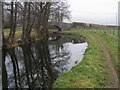
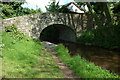
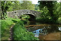
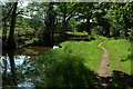

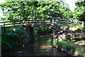
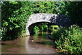

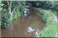
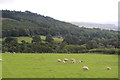
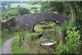
92 photos from this area
Area Information
Key information about the NP8 1LR including its size, population, and administrative classification.
- Area Type
- Postcode
- Area Size
- 75.2 hectares
- Population
- 1035
- Population Density
- 21 people/km²
House Prices in NP8 1LR
13
Properties
£346,326
Average Sold Price
£287,651
Lowest Price
£405,000
Highest Price
Showing 13 properties
| Address | Type | Beds | Baths | Last Sale Price | Last Sale Date | |
|---|---|---|---|---|---|---|
| Dan-y-wern Farm, Cyffredyn Lane, Llangynidr, Crickhowell, NP8 1LR | Detached | 3 | 1 | £287,651 | Jul 2018 | |
| Brook Cottage, Cyffredyn Lane, Llangynidr, Crickhowell, NP8 1LR | house | - | - | £405,000 | Sep 2015 | |
| Aberhoyw Cottage, B 4558 From Junction With U 0571 To Junction With C 0206 By Danywern Farm, Llangynidr, Crickhowell, NP8 1LR | Cottage | 2 | 1 | - | - | |
| Beaufort Lodge, Cyffredyn Lane, Llangynidr, Crickhowell, NP8 1LR | Detached | - | - | - | - | |
| Panteg Farm, Cyffredyn Lane, Llangynidr, Crickhowell, NP8 1LR | Detached | - | - | - | - | |
| Usk Cottage, Cyffredyn Lane, Llangynidr, Crickhowell, NP8 1LR | Detached | - | - | - | - | |
| Aberyail Farm, Cyffredyn Lane, Llangynidr, Crickhowell, NP8 1LR | house | - | - | - | - | |
| Glandwr Cottage, Cyffredyn Lane, Llangynidr, Crickhowell, NP8 1LR | house | - | - | - | - | |
| Worcester Cottage, Cyffredyn Lane, Llangynidr, Crickhowell, NP8 1LR | Detached | - | - | - | - | |
| Aberhoywe Farm, Cyffredyn Lane, Llangynidr, Crickhowell, NP8 1LR | Detached | - | - | - | - |
Page 1 of 2
Energy Efficiency in NP8 1LR
Amenities
Schools
| Rank | School | Type | Entry gender | Ages |
|---|
Explore more schools in this area
Go to Schools tabDemographics
Household Size
Two person
most common
Accommodation Type
Houses
most common
Tenure
79
majority
Ethnic Group
White
most common
Religion
N/A
most common
Household Composition
N/A
most common
Age
47
median
Adults (30-64 years)
most common
Household Deprivation
N/A
with no deprivation
NS-SEC
45
in Lower managerial occupations
Explore more demographic insights in this area
Go to Demographics tabPlanning
Planning Constraints
- Flood RiskPremium
- Ramsar Wetland SitesPremium
- Area of Outstanding Natural BeautyPremium
- Protected Nature ReservePremium
- Protected WoodlandPremium
- Crime RiskPremium