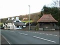
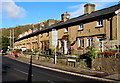
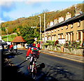
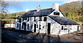
Area Overview for NP8 1DN
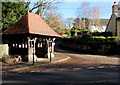
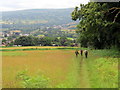
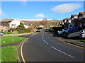
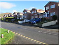
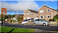
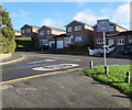
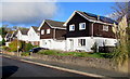
Photos of NP8 1DN
Area Information
Living in NP8 1DN means settling into a specific residential cluster within the Welsh landscape, characterised by a close-knit feel and a strong sense of stability. This postcode covers a small area of 3258 square metres, which accommodates a population of 2109 residents. The density is calculated at 338 people per square kilometre, creating an environment that is populated but not overcrowded. You will find yourself in a setting defined by its residential nature, far removed from the high-volume traffic and urban sprawl of larger cities. The character of the area is rooted in its Welsh identity, offering a distinct pace of life suitable for those seeking a quieter existence. Daily routine here involves navigating a compact community where neighbours are likely to be known by name, reflecting the tight social fabric found in many Welsh postcodes. While the physical footprint is small, the daily life extends beyond these boundaries to include the wider towns and villages that surround this settlement. The area provides a solid foundation for home ownership, with a demographic profile that supports long-term residency. Prospective buyers looking for a place to call home will appreciate the defined boundaries and the clear residential purpose of this specific location on the map.
- Area Type
- Postcode
- Area Size
- 3258 m²
- Population
- 2109
- Population Density
- 338 people/km²
Buying a home in NP8 1DN involves entering a market defined by stability and traditional housing stock. The accommodation type is exclusively houses, which removes the option of flats or purpose-built apartments from the equation for this specific property search. This implies a landscape of detached, semi-detached, or terraced homes typical of the Welsh residential belt. With 70 per cent of homes being owner-occupied, the market is driven by individuals who have likely purchased their properties in previous years, leading to a slower turnover and a stable valuation environment. You are not looking at a student let or a high-rise rental block scenario here. The small size of the postcode area, covering only 3258 square metres, means the total number of properties for sale will be limited at any given time. This scarcity contrasts with larger districts where inventory flows rapidly through the market. Homeownership levels are high enough to suggest that the area is not a pocket of temporary residence but a permanent settlement. If you are seeking a property to maintain as a primary residence, the environment supports this intent. The lack of rental density means competition is often between owner-occupiers looking to upgrade or move, rather than speculative investors.
House Prices in NP8 1DN
Showing 10 properties
| Address | Type | Beds | Baths | Last Sale Price | Last Sale Date | |
|---|---|---|---|---|---|---|
| 6, Victoria Terrace, Brecon Road, Crickhowell, NP8 1DN | Terraced | 2 | 1 | £255,000 | Mar 2024 | |
| 4, Victoria Terrace, Brecon Road, Crickhowell, NP8 1DN | Terraced | 3 | - | £295,000 | Aug 2022 | |
| 10, Victoria Terrace, Brecon Road, Crickhowell, NP8 1DN | Terraced | 2 | - | £187,500 | Apr 2016 | |
| 8, Victoria Terrace, Brecon Road, Crickhowell, NP8 1DN | Terraced | 2 | 1 | £171,500 | Jul 2015 | |
| 1, Victoria Terrace, Brecon Road, Crickhowell, NP8 1DN | Terraced | - | - | £165,000 | Feb 2012 | |
| 3, Victoria Terrace, Brecon Road, Crickhowell, NP8 1DN | Terraced | - | - | £177,500 | Aug 2007 | |
| 9, Victoria Terrace, Brecon Road, Crickhowell, NP8 1DN | Terraced | - | - | £144,000 | May 2006 | |
| 5, Victoria Terrace, Brecon Road, Crickhowell, NP8 1DN | Terraced | - | - | - | - | |
| 2, Victoria Terrace, Brecon Road, Crickhowell, NP8 1DN | Terraced | - | - | - | - | |
| 7, Victoria Terrace, Brecon Road, Crickhowell, NP8 1DN | Terraced | - | - | - | - |
Energy Efficiency in NP8 1DN
Your lifestyle as a resident of NP8 1DN revolves around a small number of convenient retail outlets within practical reach. There are five identified amenities nearby that form the backbone of daily convenience shopping. You will find a Co-op in Crickhowell, a Spar supermarket, and a Lidl in Brynmawr. These three venues offer a spectrum of high-street and budget shopping options, from daily essentials to larger grocery hauls. The Co-op and Spar likely serve the Crickhowell community centre, while Lidl provides budget-oriented shopping in Brynmawr. This cluster means you do not need a car for basic weekly shopping, yet you have enough options to suit different price points and brands. Beyond retail, the local character is defined by these practical shops rather than leisure complexes or cinemas. The convenience of these three stores integrates well with a slower pace of life, allowing residents to run errands without long commutes. Dining and entertainment options are not explicitly detailed in the nearest amenity list, suggesting a focus on utility and sustenance over nightlife or dining out. Your leisure time is spent locally, supported by the proximity of essential goods and the quiet atmosphere of the residential cluster.
Amenities
Schools
Families considering schools near NP8 1DN will find two main options in the immediate vicinity that cater to different educational needs. Crickhowell C.P. School serves as one of the key educational institutions, offering an alternative curriculum that stands apart from the standard state model. Crickhowell High School provides general secondary education for pupils within the catchment area. Both institutions fall under the 'other' category, which typically denotes private or independent schools in the Welsh context, or specific curriculum providers distinct from the maintained sector. The presence of these two distinct options gives parents a choice between different pedagogical approaches within a short commute. The mix means you are not reliant on a single state comprehensive school for your child's secondary education. While specific Ofsted ratings are not included in the local data, the existence of named schools confirms that educational provision is present for residents. You can access education without needing to travel to the larger towns for higher levels of schooling. The proximity of these facilities supports the lifestyle of parents who wish their children to remain grounded in the local community while receiving a named institutional education.
| Rank | School | Type | Entry gender | Ages |
|---|
Explore more schools in this area
Go to Schools tabDemographics
The community in NP8 1DN is defined by stability and a mature demographic profile. house ownership stands at 70 per cent, indicating that the area is heavily dominated by owners rather than renters. This high rate of ownership suggests a population invested in the locality, looking to stay put for the long term. The prevailing type of home is the house, fitting the profile of a residential area geared towards families or empty nesters rather than city dwellers in apartments. In terms of age, the median age is 47, which places the central tendency of the population firmly in the older adult bracket. The most common age range includes adults between 30 and 64 years, meaning the majority of residents are in their working or semi-retirement years. You will encounter a population where children and the very elderly are less statistically prominent than the working-age group. The predominant ethnic group is White, which aligns with the historical demographics of many established Welsh communities. There is little indication of a highly transient population, as the combination of ownership and age points to settled residents. Deprivation data is not available for this specific postcode, so assessments of quality of life must rely on the visible indicators of stability and ownership rates.
Household Size
Accommodation Type
Tenure
Ethnic Group
Religion
Household Composition
Age
Household Deprivation
NS-SEC
Explore more demographic insights in this area
Go to Demographics tabPlanning
Planning Constraints
- Flood RiskPremium
- Ramsar Wetland SitesPremium
- Area of Outstanding Natural BeautyPremium
- Protected Nature ReservePremium
- Protected WoodlandPremium
- Crime RiskPremium