Area Overview for NP8 1SE
Photos of NP8 1SE
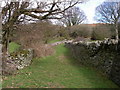
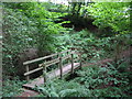
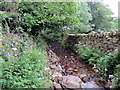
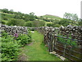
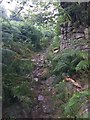
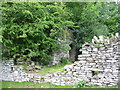
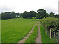
8 photos from this area
Area Information
Key information about the NP8 1SE including its size, population, and administrative classification.
- Area Type
- Postcode
- Area Size
- 1.9 km²
- Population
- 2109
- Population Density
- 338 people/km²
House Prices in NP8 1SE
25
Properties
£672,653
Average Sold Price
£299,950
Lowest Price
£1,050,815
Highest Price
Showing 25 properties
| Address | Type | Beds | Baths | Last Sale Price | Last Sale Date | |
|---|---|---|---|---|---|---|
| Larchfield House, Pregge Lane, Crickhowell, NP8 1SE | Detached | 6 | 5 | £1,050,815 | Jul 2024 | |
| Nanteos, Pregge Lane, Crickhowell, NP8 1SE | house | - | - | £937,500 | Aug 2022 | |
| The Twyn, Pregge Lane, Crickhowell, NP8 1SE | house | - | - | £299,950 | Oct 2013 | |
| Willowbrook, Pregge Lane, Crickhowell, NP8 1SE | Bungalow | 4 | - | £535,000 | Aug 2012 | |
| Ty Cwmbeth, Pregge Lane, Crickhowell, NP8 1SE | house | - | - | £540,000 | Mar 2011 | |
| The Old Coach House, Gwernvale, Brecon Road, Crickhowell, NP8 1SE | Detached | 3 | 3 | - | - | |
| Pregge Mill, Pregge Lane, Crickhowell, NP8 1SE | Detached | 4 | 3 | - | - | |
| Inglebrook, Pregge Lane, Crickhowell, NP8 1SE | Detached | - | - | - | - | |
| Ymyl Y Nant, Pregge Lane, Crickhowell, NP8 1SE | house | - | - | - | - | |
| The Old Potting Shed, Gwernvale Farm, A 40 T From Brecon Road Crickhowell To Junction With A 479 T At Nantyffin, Crickhowell, NP8 1SE | house | - | - | - | - |
Page 1 of 3
Energy Efficiency in NP8 1SE
Amenities
Schools
| Rank | School | Type | Entry gender | Ages |
|---|
Explore more schools in this area
Go to Schools tabDemographics
Household Size
Two person
most common
Accommodation Type
Houses
most common
Tenure
70
majority
Ethnic Group
White
most common
Religion
N/A
most common
Household Composition
N/A
most common
Age
47
median
Adults (30-64 years)
most common
Household Deprivation
N/A
with no deprivation
NS-SEC
42
in Lower managerial occupations
Explore more demographic insights in this area
Go to Demographics tabPlanning
Planning Constraints
- Flood RiskPremium
- Ramsar Wetland SitesPremium
- Area of Outstanding Natural BeautyPremium
- Protected Nature ReservePremium
- Protected WoodlandPremium
- Crime RiskPremium