Area Overview for NP8 1AF
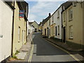
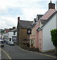
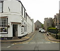
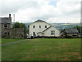
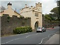
Photos of NP8 1AF

Area Information
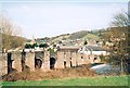
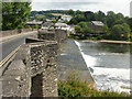
Living in NP8 1AF offers a residential experience defined by its specific postcode cluster within the wider town of Crickhowell. This area covers a total size of 4,326 square metres, creating a compact living environment for its population of 2,109 people. The density here stands at 338 people per square kilometre, which suggests a managed community where neighbours are within easy reach but privacy remains intact. You will find yourself situated in a part of Wales that balances close proximity with residential calm. The character of daily life in this location is shaped by these hard numbers. The small footprint of the postcode means that local streets are likely populated by residents who know one another, yet the specific layout avoids the overcrowding found in denser urban centres. With over 3,000 residents per square kilometre representing much of the immediate vicinity, the intensity increases slightly beyond this specific plot, maintaining a suburban feel. You live in a space where the built environment is functional and established, catering primarily to those seeking a stable home base away from the seafront and city centre. This area represents a solid choice for those prioritising location within Crickhowell. The immediate surroundings are built to accommodate housing rather than heavy industry or commercial sprawl. When you consider living in NP8 1AF, you are choosing a community with a clear identity. The neighbourhood functions as a distinct residential zone rather than a mixed-use commercial district.
- Area Type
- Postcode
- Area Size
- 4326 m²
- Population
- 2109
- Population Density
- 338 people/km²
The property market in NP8 1AF is characterised by a strong preference for ownership. With 70% of households being owner-occupied, this postcode serves as a hub for long-term residents rather than transient renters. The accommodation is primarily houses, meaning you will find detached or semi-detached properties dominating the landscape. This configuration is typical for areas where families require space for vehicles and gardens, fitting the profile of those with children or elderly relatives. Because the area consists of Postcode NP8 1AF specifically, the housing stock is limited and well-defined. You cannot purchase a flat in this particular cluster; the market is exclusive to houses. This constraint simplifies your search but narrows your options significantly. The high ownership rate suggests that properties here are often sold through formal channels rather than informal lettings. When you look for homes in NP8 1AF, you are entering a competitive local market. The small area size of 4,326 square metres indicates that supply is naturally restricted. Buyer competition will rise if a suitable property comes to market, as opposing sellers typically face low vacancy rates. The prevalence of houses over flats aligns with the demographic reality that adults aged 30 to 64 years prefer larger living spaces.
House Prices in NP8 1AF
Showing 4 properties
| Address | Type | Beds | Baths | Last Sale Price | Last Sale Date | |
|---|---|---|---|---|---|---|
| Orchard Lea, Greenhill Way, Crickhowell, NP8 1AF | Bungalow | - | - | £495,000 | May 2023 | |
| Tan Y Bryn, 0 Greenhill Way, Crickhowell, NP8 1AF | Bungalow | 3 | 2 | £450,000 | Mar 2016 | |
| Dan-y-lan, Greenhill Way, Crickhowell, NP8 1AF | house | - | - | £580,000 | Oct 2011 | |
| Ty Clyd, Greenhill Way, Crickhowell, NP8 1AF | Detached | - | - | £295,000 | Feb 2003 |
Energy Efficiency in NP8 1AF
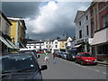
Daily life in NP8 1AF is defined by accessibility to essential retail and transport hubs. Within practical reach, you have five distinct retail options to choose from. The major high street names include Co-op Crickhowell and Spar for your weekly groceries, along with Lidl Brynmawr for value-conscious shopping. These supermarkets ensure you have access to fresh food and household essentials without driving far from home. Transport links are equally straightforward, anchored by a single nearby rail station. Abergavenny Railway Station serves as the northern gateway for residents heading towards major cities or business parks. This rail connection forms the backbone of your commute network. With these amenities located at the doorstep of the postcode, you save time on daily errands. The lifestyle here is practical and functional. You do not need to leave the neighbourhood to shop or catch a train. The presence of Co-op and Lidl means you have variety in your grocery budget, while Crickhowell High School and Crickhowell C.P. School keep education local. Your daily rhythm revolves around these key hubs. Shopping trips to Spar are quick, and train journeys begin from the nearby platform at Abergavenny. This layout supports an independent lifestyle where convenience is prioritised over luxury or divergence.
Amenities
Schools
Families considering schools near NP8 1AF have two specific options listed within the immediate vicinity of Crickhowell. Crickhowell C.P. School operates as a community or primary institution, serving the younger population of the area. Crickhowell High School functions as the secondary partner, catering to older students up to age 16 or 18 depending on the local curriculum structure. Both institutions are classified under the "other" type category, which often denotes community schools in the Welsh system. This classification suggests a public funding model focused on local needs rather than privateSelectivity. The proximity of these two buildings provides a coherent educational path for a resident child moving from infancy through adolescence. You do not need to commute to a distant town for basic and secondary education. The presence of these two named schools means that local parents can access education without moving house. Crickhowell C.P. School handles early years while Crickhowell High School manages upper key stages. This local concentration supports the family demographic found in the area, where a median age of 47 implies many children are either young or ageing out of the system. The accessibility of these educational facilities is a key factor for any homebuyer weighing the total cost of living in this postcode.
| Rank | School | Type | Entry gender | Ages |
|---|
Explore more schools in this area
Go to Schools tabDemographics
The community in NP8 1AF is distinctly mature, with a median age of 47 years. Most residents fall into the adult bracket between 30 and 64 years of age. This demographic profile indicates an area favoured by families with older children or retirees who have downsized. The vast majority of the population identifies as White, reflecting the traditional makeup of the local Welsh community. Home ownership is the dominant feature of life here, with 70% of households being owner-occupied. This high figure signals a stable, long-term settlement where investment is prevalent. Residential density is calculated at 338 people per square kilometre, suggesting a moderate balance between available space and community engagement. You are less likely to encounter frequent tenant turnover in this neighbourhood compared to high-rental zones. The accommodation is exclusively composed of houses. This constraint is common for search results focused on specific postcodes within this region, as flats are not the primary stock. The absence of rental data in the provided figures further supports the view that this is an owner-driven market. Residents here have secured their homes, creating a sense of permanence. The population size of 2,109 confirms that you are part of a cohesive community rather than a sprawling metropolis.
Household Size
Accommodation Type
Tenure
Ethnic Group
Religion
Household Composition
Age
Household Deprivation
NS-SEC
Explore more demographic insights in this area
Go to Demographics tabPlanning
Planning Constraints
- Flood RiskPremium
- Ramsar Wetland SitesPremium
- Area of Outstanding Natural BeautyPremium
- Protected Nature ReservePremium
- Protected WoodlandPremium
- Crime RiskPremium