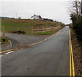
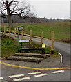
Area Overview for NP8 1BS
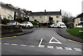
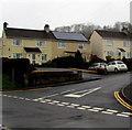
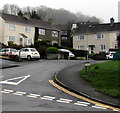
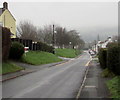
Photos of NP8 1BS
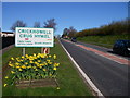
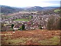
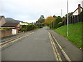
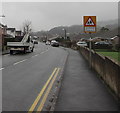

Area Information
Living in NP8 1BS offers a grounded existence within a specific residential cluster in Wales. This postcode covers a small area with a population of 2,109 residents, creating a tight-knit environment where neighbours are likely to know each other. With a population density of 338 people per square kilometre, the area feels quieter than many urban centres yet remains accessible to local services. The community is defined by established homes rather than vast estates, fostering a sense of stability for those who choose to settle here. It is a place where daily life revolves around practical needs and local connections, removing the noise and rush of larger towns. Prospective buyers will find this location distinct because of its manageable scale and clear community fabric. The area functions as a self-contained residential zone where every household contributes to a shared pattern of over seventy per cent home ownership. This high rate of ownership suggests a stable community where people have chosen to put down roots rather than store boxes. The residential character dominates the landscape, ensuring that your garden view is primarily of other homes or open space rather than industrial sites. For those considering NP8 1BS, the location represents a straightforward choice for homeowners seeking a low-density lifestyle in South Wales. The absence of major planning constraints means the current character of the area is secure from large-scale developments that might disrupt the quiet streets. Daily life here relies on the proximity to nearby towns and the reliability of local bus routes or trains. You can expect a environment where the pace of life is set by the sunrise and the needs of a mature community rather than the demands of a twenty-four-hour city.
- Area Type
- Postcode
- Area Size
- Not available
- Population
- 2109
- Population Density
- 338 people/km²
The property market in NP8 1BS is characterised by a scarcity of rental opportunities driven by high owner occupancy levels. With 70 per cent of residents owning their homes, this area functions largely as an investment market for first-time buyers or moved-up families rather than a hub for private landlords. The housing stock consists overwhelmingly of houses, meaning you will not find clusters of flats or maisonettes typical of urban regeneration zones. This uniformity in accommodation type supports a specific lifestyle where privacy and space are standard expectations for every purchaser. Buyers looking at homes in NP8 1BS should anticipate a market where competition is fierce among owner-occupiers rather than investors. The high ownership rate implies that any available properties for sale are likely to be passed between long-term residents rather than newly entered investors. This dynamic often results in less price volatility compared to areas with high rental turnover. The dominance of houses aligns with the preference of the local demographic, who value the space and structure of traditional Welsh homes. Consequently, the scope for buying converted industrial units or city apartments is non-existent in this specific cluster. For those entering this market, the implication is clear: success depends on understanding the specific needs of a mature, owner-led community. Sellers in this area know that their client base consists of people who have stayed put for decades. This stability creates a transparent environment where property values are supported by genuine local demand rather than speculative interest. You can expect to deal with homeowners who value their property's history and location as integral to the sale process. The market is orderly, reflecting the orderly demographic makeup of the residents who rely on houses as their primary form of accommodation.
House Prices in NP8 1BS
No properties found in this postcode.
Energy Efficiency in NP8 1BS
The lifestyle for residents of NP8 1BS revolves around practical accessibility to well-known local chains and traditional market towns. Within practical reach, you have access to five retail outlets that form the backbone of daily shopping activities. Co-op Crickhowell acts as a central hub for groceries and household needs, providing most residents with everything required for their weekly shopping. Nearby Spar stores complement this offering with essentials and convenience items, ensuring that quick trips can be made without traveling far. Further out, Lidl Brynmawr is a significant draw for cost-conscious shoppers seeking larger supermarket volumes. This supermarket is a key amenity for families buying in bulk, reducing the frequency of visits to smaller local shops. The availability of these three specific retailers ensures that your daily errands can be completed efficiently without the need for long journeys. The combination of these stores provides a balanced mix of premium and essential shop options tailored to the needs of families and individuals alike. Transport links are supported by one major railway station, Abergavenny Railway Station. This station serves as a vital gateway for commuters and travelers wishing to reach larger destinations beyond the valley. The connection to the rail network means that you can reach major cities and business hubs with relative ease. The presence of this station adds a layer of connectivity to the predominantly rural and residential character of the area. You do not need to rely solely on cars for long-distance travel, offering flexibility for meetings or weekend trips. The blend of these amenities creates a lifestyle where convenience is balanced with the quietude of a residential cluster.
Amenities
Schools
Families considering schools near NP8 1BS have access to key local education providers that serve the immediate wider valley area. Both Crickhowell C.P. School and Crickhowell High School are located nearby, offering comprehensive education options for children growing up in the region. These institutions serve as the primary educational anchors for the local community, providing continuity for students from early years through to secondary education within the South Wales Valleys. The presence of these two named schools means that residents can choose between different educational settings without needing to commute long distances to larger towns. Crickhowell C.P. School typically caters to younger pupils, while Crickhowell High School offers secondary education. While specific Ofsted ratings are not detailed in the current data, the existence of these established institutions indicates a commitment to local education provision. This setup supports families who prefer their children to be educated close to home, reducing travel time and fostering local community engagement among parents. For you as a future buyer, the concentration of schools in this location offers practical advantages. The schools are situated close enough to be part of the daily rhythm of life for residents of NP8 1BS. This proximity allows for easier participation in school events, parent-teacher conferences, and community fundraising activities. The network of schools also provides a sense of security and routine for families, knowing that their children are attending well-established institutions rather than temporary or newly formed academies. The educational options are focused on traditional methods that have served the locality for generations.
| Rank | School | Type | Entry gender | Ages |
|---|
Explore more schools in this area
Go to Schools tabDemographics
The community profile of NP8 1BS reflects a mature and settled population. The median age of residents is 47 years, indicating that the area is populated primarily by adults between thirty and sixty-four years old. This demographic skew suggests a neighbourhood where families with older children, empty nesters, and retired couples form the backbone of society. You will find very few young families with toddlers or teenagers under the age of ten, which shapes the local atmosphere and the types of facilities used daily. Home ownership is exceptionally strong within this postcode, standing at 70 per cent. This figure is significantly higher than the national average and points to an area where stability is the norm rather than renting. The production of new tenancies is likely low compared to recent purchaser take-ups, creating a market that favours existing property investments. Almost all residents live in houses, making it unlikely to find flat-living complexes or converted apartments in the immediate vicinity. This housing type suits the demographic profile of adults who value private outdoor space and detached or semi-detached living arrangements. The ethnic composition of the area is predominantly White, reflecting a traditional community makeup common in parts of South Wales. While the area remains culturally diverse in spirit, the statistics show a clear majority group living here. The high rate of longer-term ownership likely contributes to a slower community turnover, where families remain in their homes for decades. For you as a potential buyer, this means joining an established community rather than entering a transient rental sector. The social fabric is woven from long-standing relationships, which often translate into greater support networks for neighbours.
Household Size
Accommodation Type
Tenure
Ethnic Group
Religion
Household Composition
Age
Household Deprivation
NS-SEC
Explore more demographic insights in this area
Go to Demographics tabPlanning
Planning Constraints
- Flood RiskPremium
- Ramsar Wetland SitesPremium
- Area of Outstanding Natural BeautyPremium
- Protected Nature ReservePremium
- Protected WoodlandPremium
- Crime RiskPremium