Area Overview for LD7 1SA
Photos of LD7 1SA

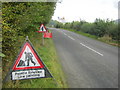
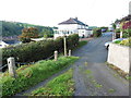


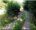
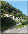
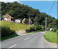
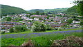

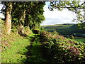
16 photos from this area
Area Information
Key information about the LD7 1SA including its size, population, and administrative classification.
- Area Type
- Postcode
- Area Size
- 34.0 hectares
- Population
- 1395
- Population Density
- 97 people/km²
House Prices in LD7 1SA
9
Properties
£271,600
Average Sold Price
£165,000
Lowest Price
£373,000
Highest Price
Showing 9 properties
| Address | Type | Beds | Baths | Last Sale Price | Last Sale Date | |
|---|---|---|---|---|---|---|
| Garth Cottage, Garth Lane, Knighton, LD7 1SA | Retail | 4 | 1 | £365,000 | Dec 2022 | |
| Pine Cottage, Garth Lane, Knighton, LD7 1SA | Retail | 7 | 4 | £373,000 | Aug 2021 | |
| The View, Garth Lane, Knighton, LD7 1SA | Detached | 4 | - | £220,000 | Jan 2014 | |
| Well House, Garth Lane, Knighton, LD7 1SA | house | - | - | £235,000 | Sep 2011 | |
| 1, Bryn Y Dre, Garth Lane, Knighton, LD7 1SA | Semi-detached | - | - | £165,000 | Sep 2007 | |
| Rock House, Garth Lane, Knighton, LD7 1SA | Detached | - | - | - | - | |
| Old Orchard, Garth Lane, Knighton, LD7 1SA | Bungalow | - | - | - | - | |
| 2, Bryn Y Dre, Garth Lane, Knighton, LD7 1SA | Semi-detached | - | - | - | - | |
| Upper Garth, Garth Lane, Knighton, LD7 1SA | house | - | - | - | - |
Energy Efficiency in LD7 1SA
Amenities
Schools
| Rank | School | Type | Entry gender | Ages |
|---|
Explore more schools in this area
Go to Schools tabDemographics
Household Size
Two person
most common
Accommodation Type
Houses
most common
Tenure
70
majority
Ethnic Group
White
most common
Religion
N/A
most common
Household Composition
N/A
most common
Age
47
median
Adults (30-64 years)
most common
Household Deprivation
N/A
with no deprivation
NS-SEC
23
in Lower managerial occupations
Explore more demographic insights in this area
Go to Demographics tabPlanning
Planning Constraints
- Flood RiskPremium
- Ramsar Wetland SitesPremium
- Area of Outstanding Natural BeautyPremium
- Protected Nature ReservePremium
- Protected WoodlandPremium
- Crime RiskPremium