Area Overview for SA73 1PB
Photos of SA73 1PB
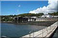


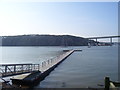
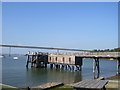
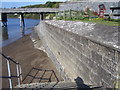


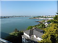
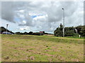
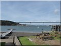
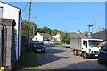
47 photos from this area
Area Information
Key information about the SA73 1PB including its size, population, and administrative classification.
- Area Type
- Postcode
- Area Size
- 2.9 hectares
- Population
- 1857
- Population Density
- 90 people/km²
House Prices in SA73 1PB
4
Properties
£835,000
Average Sold Price
£835,000
Lowest Price
£835,000
Highest Price
Showing 4 properties
| Address | Type | Beds | Baths | Last Sale Price | Last Sale Date | |
|---|---|---|---|---|---|---|
| Tower House, Barnlake Point, Burton Ferry, Milford Haven, SA73 1PB | Detached | 4 | 5 | £835,000 | Oct 2023 | |
| Rhyd Y Groes, C 3007 Junction Jolly Sailor Slip Road To Junction A 477 Cleddau Bridge, Burton Ferry, Milford Haven, SA73 1PB | Detached | 6 | 3 | - | - | |
| The Anchorage, C 3007 Junction Jolly Sailor Slip Road To Junction A 477 Cleddau Bridge, Burton Ferry, Milford Haven, SA73 1PB | Detached | - | - | - | - | |
| 2, Mount Pleasant, Barnlake Point, Burton Ferry, Milford Haven, SA73 1PB | Terraced | - | - | - | - |
Energy Efficiency in SA73 1PB
Amenities
Schools
| Rank | School | Type | Entry gender | Ages |
|---|
Explore more schools in this area
Go to Schools tabDemographics
Household Size
Two person
most common
Accommodation Type
Houses
most common
Tenure
85
majority
Ethnic Group
White
most common
Religion
N/A
most common
Household Composition
N/A
most common
Age
47
median
Adults (30-64 years)
most common
Household Deprivation
N/A
with no deprivation
NS-SEC
37
in Lower managerial occupations
Explore more demographic insights in this area
Go to Demographics tabPlanning
Planning Constraints
- Flood RiskPremium
- Ramsar Wetland SitesPremium
- Area of Outstanding Natural BeautyPremium
- Protected Nature ReservePremium
- Protected WoodlandPremium
- Crime RiskPremium