Area Overview for SA72 6UD
Photos of SA72 6UD


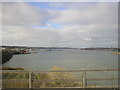

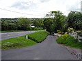
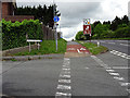

67 photos from this area
Area Information
Key information about the SA72 6UD including its size, population, and administrative classification.
- Area Type
- Postcode
- Area Size
- 32.4 hectares
- Population
- 1215
- Population Density
- 1774 people/km²
House Prices in SA72 6UD
34
Properties
£174,523
Average Sold Price
£55,000
Lowest Price
£319,750
Highest Price
Showing 34 properties
| Address | Type | Beds | Baths | Last Sale Price | Last Sale Date | |
|---|---|---|---|---|---|---|
| West Winds, Pembroke Ferry, Pembroke Dock, SA72 6UD | Detached | - | - | £319,750 | Mar 2021 | |
| Sandpipers, 14 Pembroke Ferry, Pembroke Dock, SA72 6UD | Cottage | 2 | 1 | £150,000 | Sep 2018 | |
| 36 Pembroke Ferry, Pembroke Dock, SA72 6UD | house | - | - | £120,000 | Apr 2015 | |
| Sea Melody, 38 Pembroke Ferry, Pembroke Dock, SA72 6UD | house | - | - | £173,000 | Jun 2011 | |
| Beachcroft, Pembroke Ferry, Pembroke Dock, SA72 6UD | Detached | - | - | £245,000 | Aug 2009 | |
| 20 Pembroke Ferry, Pembroke Dock, SA72 6UD | Terraced | 2 | 1 | £127,500 | Dec 2007 | |
| Halycon, Pembroke Ferry, Pembroke Dock, SA72 6UD | Detached | - | - | £207,500 | Oct 2003 | |
| Ferry Wood House, Pembroke Ferry, Pembroke Dock, SA72 6UD | Bungalow | 3 | 2 | £317,500 | Mar 2003 | |
| Tides Reach, Pembroke Ferry, Pembroke Dock, SA72 6UD | Detached | - | - | £132,500 | Dec 2001 | |
| Tudor Cottage, 12 Pembroke Ferry, Pembroke Dock, SA72 6UD | Detached | - | - | £55,000 | Jul 1996 |
Page 1 of 4
Energy Efficiency in SA72 6UD
Amenities
Schools
| Rank | School | Type | Entry gender | Ages |
|---|
Explore more schools in this area
Go to Schools tabDemographics
Household Size
One person
most common
Accommodation Type
Houses
most common
Tenure
68
majority
Ethnic Group
White
most common
Religion
N/A
most common
Household Composition
N/A
most common
Age
47
median
Adults (30-64 years)
most common
Household Deprivation
N/A
with no deprivation
NS-SEC
22
in Lower managerial occupations
Explore more demographic insights in this area
Go to Demographics tabPlanning
Planning Constraints
- Flood RiskPremium
- Ramsar Wetland SitesPremium
- Area of Outstanding Natural BeautyPremium
- Protected Nature ReservePremium
- Protected WoodlandPremium
- Crime RiskPremium