Area Overview for SA73 1JA
Photos of SA73 1JA

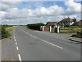
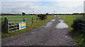


13 photos from this area
Area Information
Key information about the SA73 1JA including its size, population, and administrative classification.
- Area Type
- Postcode
- Area Size
- 10.7 hectares
- Population
- 1573
- Population Density
- 555 people/km²
House Prices in SA73 1JA
66
Properties
£155,659
Average Sold Price
£29,950
Lowest Price
£450,000
Highest Price
Showing 66 properties
| Address | Type | Beds | Baths | Last Sale Price | Last Sale Date | |
|---|---|---|---|---|---|---|
| 52 Conway Drive, Steynton, Milford Haven, SA73 1JA | Detached | 4 | 2 | £390,000 | Sep 2025 | |
| 9 Conway Drive, Steynton, Milford Haven, SA73 1JA | Terraced | 2 | - | £135,000 | Jul 2025 | |
| 60 Conway Drive, Steynton, Milford Haven, SA73 1JA | Detached | 4 | 4 | £375,000 | Aug 2024 | |
| 37A Conway Drive, Steynton, Milford Haven, SA73 1JA | Semi-detached | 3 | 2 | £166,000 | Aug 2023 | |
| 18 Conway Drive, Steynton, Milford Haven, SA73 1JA | Semi-detached | 2 | 1 | £130,000 | Mar 2023 | |
| 17 Conway Drive, Steynton, Milford Haven, SA73 1JA | Semi-detached | 3 | 1 | £159,950 | Feb 2023 | |
| 42 Conway Drive, Steynton, Milford Haven, SA73 1JA | Detached | 6 | 2 | £450,000 | Feb 2023 | |
| 7 Conway Drive, Steynton, Milford Haven, SA73 1JA | Terraced | 2 | 1 | £125,000 | Aug 2022 | |
| 40 Conway Drive, Steynton, Milford Haven, SA73 1JA | Bungalow | 3 | 2 | £315,000 | Jun 2022 | |
| 15 Conway Drive, Steynton, Milford Haven, SA73 1JA | house | - | - | £165,000 | Nov 2021 |
Page 1 of 7
Energy Efficiency in SA73 1JA
Amenities
Schools
| Rank | School | Type | Entry gender | Ages |
|---|
Explore more schools in this area
Go to Schools tabDemographics
Household Size
Two person
most common
Accommodation Type
Houses
most common
Tenure
64
majority
Ethnic Group
White
most common
Religion
N/A
most common
Household Composition
N/A
most common
Age
47
median
Adults (30-64 years)
most common
Household Deprivation
N/A
with no deprivation
NS-SEC
28
in Lower managerial occupations
Explore more demographic insights in this area
Go to Demographics tabPlanning
Planning Constraints
- Flood RiskPremium
- Ramsar Wetland SitesPremium
- Area of Outstanding Natural BeautyPremium
- Protected Nature ReservePremium
- Protected WoodlandPremium
- Crime RiskPremium