Area Overview for SA72 6BQ
Photos of SA72 6BQ
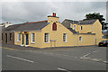
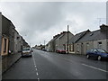
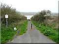
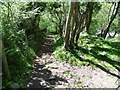
39 photos from this area
Area Information
Key information about the SA72 6BQ including its size, population, and administrative classification.
- Area Type
- Postcode
- Area Size
- 1.1 hectares
- Population
- 1715
- Population Density
- 1755 people/km²
House Prices in SA72 6BQ
22
Properties
£94,625
Average Sold Price
£36,000
Lowest Price
£183,750
Highest Price
Showing 22 properties
| Address | Type | Beds | Baths | Last Sale Price | Last Sale Date | |
|---|---|---|---|---|---|---|
| 14 Picton Place, Pembroke Dock, SA72 6BQ | Bungalow | 2 | 1 | £183,750 | Dec 2025 | |
| 13 Picton Place, Pembroke Dock, SA72 6BQ | Terraced | 2 | 1 | £182,500 | Sep 2025 | |
| 12 Picton Place, Pembroke Dock, SA72 6BQ | Terraced | 2 | 1 | £150,000 | Mar 2025 | |
| High View, Picton Place, Pembroke Dock, SA72 6BQ | house | - | - | £39,000 | Feb 2019 | |
| 3 Picton Place, Pembroke Dock, SA72 6BQ | Terraced | 3 | 1 | £69,500 | Feb 2016 | |
| 15 Picton Place, Pembroke Dock, SA72 6BQ | Detached | - | - | £110,000 | Aug 2009 | |
| 4 Picton Place, Pembroke Dock, SA72 6BQ | Terraced | 3 | 1 | £120,000 | Apr 2008 | |
| 10 Picton Place, Pembroke Dock, SA72 6BQ | Bungalow | - | - | £140,000 | Mar 2007 | |
| 11 Picton Place, Pembroke Dock, SA72 6BQ | Detached | - | - | £109,000 | Apr 2005 | |
| 19 Picton Place, Pembroke Dock, SA72 6BQ | Bungalow | 3 | 1 | £55,000 | Nov 2002 |
Page 1 of 3
Energy Efficiency in SA72 6BQ
Amenities
Schools
| Rank | School | Type | Entry gender | Ages |
|---|
Explore more schools in this area
Go to Schools tabDemographics
Household Size
Two person
most common
Accommodation Type
Houses
most common
Tenure
52
majority
Ethnic Group
White
most common
Religion
N/A
most common
Household Composition
N/A
most common
Age
47
median
Adults (30-64 years)
most common
Household Deprivation
N/A
with no deprivation
NS-SEC
18
in Lower managerial occupations
Explore more demographic insights in this area
Go to Demographics tabPlanning
Planning Constraints
- Flood RiskPremium
- Ramsar Wetland SitesPremium
- Area of Outstanding Natural BeautyPremium
- Protected Nature ReservePremium
- Protected WoodlandPremium
- Crime RiskPremium