Area Overview for SA72 6BD
Photos of SA72 6BD

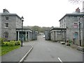
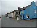

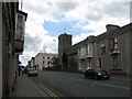
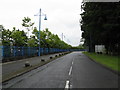
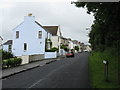
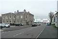
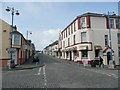
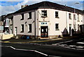

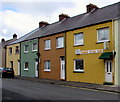
100 photos from this area
Area Information
Key information about the SA72 6BD including its size, population, and administrative classification.
- Area Type
- Postcode
- Area Size
- 1.0 hectares
- Population
- 1805
- Population Density
- 1460 people/km²
House Prices in SA72 6BD
35
Properties
£96,510
Average Sold Price
£22,500
Lowest Price
£380,000
Highest Price
Showing 35 properties
| Address | Type | Beds | Baths | Last Sale Price | Last Sale Date | |
|---|---|---|---|---|---|---|
| Llanmedos, 24 Prospect Place, Pembroke Dock, SA72 6BD | house | 3 | - | £80,500 | Sep 2025 | |
| The Mount, 54 Prospect Place, Pembroke Dock, SA72 6BD | Terraced | 5 | 2 | £380,000 | Mar 2022 | |
| 46 Prospect Place, Pembroke Dock, SA72 6BD | house | - | - | £140,000 | Nov 2021 | |
| Llanbeor, 37 Prospect Place, Pembroke Dock, SA72 6BD | house | - | - | £100,000 | Jan 2021 | |
| 31 Prospect Place, Pembroke Dock, SA72 6BD | Terraced | 3 | - | £80,000 | Jan 2020 | |
| 32 Prospect Place, Pembroke Dock, SA72 6BD | Block of Flats | 4 | 2 | £120,000 | Jul 2019 | |
| 35 Prospect Place, Pembroke Dock, SA72 6BD | Terraced | 3 | 1 | £62,000 | Oct 2018 | |
| 39 Prospect Place, Pembroke Dock, SA72 6BD | Terraced | 4 | - | £76,500 | Nov 2016 | |
| 40 Prospect Place, Pembroke Dock, SA72 6BD | Terraced | 3 | 1 | £122,250 | Mar 2016 | |
| 42 Prospect Place, Pembroke Dock, SA72 6BD | house | - | - | £96,000 | Feb 2016 |
Page 1 of 4
Energy Efficiency in SA72 6BD
Amenities
Schools
| Rank | School | Type | Entry gender | Ages |
|---|
Explore more schools in this area
Go to Schools tabDemographics
Household Size
One person
most common
Accommodation Type
Houses
most common
Tenure
62
majority
Ethnic Group
White
most common
Religion
N/A
most common
Household Composition
N/A
most common
Age
47
median
Adults (30-64 years)
most common
Household Deprivation
N/A
with no deprivation
NS-SEC
24
in Lower managerial occupations
Explore more demographic insights in this area
Go to Demographics tabPlanning
Planning Constraints
- Flood RiskPremium
- Ramsar Wetland SitesPremium
- Area of Outstanding Natural BeautyPremium
- Protected Nature ReservePremium
- Protected WoodlandPremium
- Crime RiskPremium