Area Overview for SA36 0EA
Photos of SA36 0EA


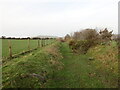
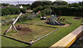

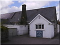

13 photos from this area
Area Information
Key information about the SA36 0EA including its size, population, and administrative classification.
- Area Type
- Postcode
- Area Size
- 2.0 hectares
- Population
- 1293
- Population Density
- 46 people/km²
House Prices in SA36 0EA
18
Properties
£208,818
Average Sold Price
£10,000
Lowest Price
£430,000
Highest Price
Showing 18 properties
| Address | Type | Beds | Baths | Last Sale Price | Last Sale Date | |
|---|---|---|---|---|---|---|
| 14 Parc Yr Eos, Hermon, Glogue, SA36 0EA | Detached | 4 | 2 | £430,000 | Mar 2023 | |
| 8 Parc Yr Eos, Hermon, Glogue, SA36 0EA | Detached | 4 | 3 | £390,000 | Mar 2023 | |
| 17 Parc Yr Eos, Hermon, Glogue, SA36 0EA | Detached | 3 | 2 | £10,000 | Dec 2021 | |
| 11 Parc Yr Eos, Hermon, Glogue, SA36 0EA | Bungalow | 3 | 2 | £285,000 | Jun 2021 | |
| 9 Parc Yr Eos, Hermon, Glogue, SA36 0EA | Bungalow | 3 | - | £210,000 | Feb 2019 | |
| 10 Parc Yr Eos, Hermon, Glogue, SA36 0EA | Bungalow | - | - | £168,000 | Aug 2018 | |
| 1 Parc Yr Eos, Hermon, Glogue, SA36 0EA | Detached | 4 | 2 | £160,000 | Jun 2015 | |
| 19 Parc Yr Eos, Hermon, Glogue, SA36 0EA | Land | - | - | £189,000 | Jul 2014 | |
| 12 Parc Yr Eos, Hermon, Glogue, SA36 0EA | house | - | - | £150,000 | Mar 2014 | |
| Hafan Glogue, 15 Parc Yr Eos, Hermon, Glogue, SA36 0EA | Detached | 3 | 1 | £250,000 | Sep 2007 |
Page 1 of 2
Energy Efficiency in SA36 0EA
Amenities
Schools
| Rank | School | Type | Entry gender | Ages |
|---|
Explore more schools in this area
Go to Schools tabDemographics
Household Size
Two person
most common
Accommodation Type
Houses
most common
Tenure
77
majority
Ethnic Group
White
most common
Religion
N/A
most common
Household Composition
N/A
most common
Age
47
median
Adults (30-64 years)
most common
Household Deprivation
N/A
with no deprivation
NS-SEC
27
in Lower managerial occupations
Explore more demographic insights in this area
Go to Demographics tabPlanning
Planning Constraints
- Flood RiskPremium
- Ramsar Wetland SitesPremium
- Area of Outstanding Natural BeautyPremium
- Protected Nature ReservePremium
- Protected WoodlandPremium
- Crime RiskPremium