Area Overview for SA36 0DS
Photos of SA36 0DS
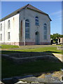
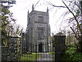
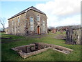
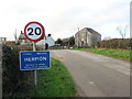
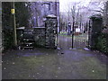
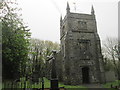
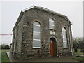
10 photos from this area
Area Information
Key information about the SA36 0DS including its size, population, and administrative classification.
- Area Type
- Postcode
- Area Size
- 46.9 hectares
- Population
- 1293
- Population Density
- 46 people/km²
House Prices in SA36 0DS
38
Properties
£180,917
Average Sold Price
£54,000
Lowest Price
£424,500
Highest Price
Showing 38 properties
| Address | Type | Beds | Baths | Last Sale Price | Last Sale Date | |
|---|---|---|---|---|---|---|
| Tegfan, C 3037 Llanfyrnach To Hermon, Hermon, Glogue, SA36 0DS | Detached | 3 | 1 | £200,000 | Jun 2024 | |
| Penllys, C 3037 Llanfyrnach To Hermon, Hermon, Glogue, SA36 0DS | Detached | 4 | 2 | £280,000 | Apr 2024 | |
| Chapel House, C 3037 Llanfyrnach To Hermon, Hermon, Glogue, SA36 0DS | Detached | - | - | £424,500 | Nov 2023 | |
| Arosfa, C 3037 Llanfyrnach To Hermon, Hermon, Glogue, SA36 0DS | Bungalow | 5 | 2 | £220,000 | Jun 2021 | |
| Fronwen, C 3037 Llanfyrnach To Hermon, Hermon, Glogue, SA36 0DS | Land | 3 | 3 | £239,000 | May 2021 | |
| Cartref, C 3037 Llanfyrnach To Hermon, Hermon, Glogue, SA36 0DS | Bungalow | 4 | 2 | £180,000 | Oct 2019 | |
| Yr Hafod, C 3037 Llanfyrnach To Hermon, Hermon, Glogue, SA36 0DS | Detached | - | - | £95,000 | Apr 2007 | |
| Hafodwen, C 3037 Llanfyrnach To Hermon, Hermon, Glogue, SA36 0DS | house | - | - | £115,000 | Jun 2005 | |
| Cae Bach, C 3037 Llanfyrnach To Hermon, Hermon, Glogue, SA36 0DS | house | - | - | £227,500 | Dec 2003 | |
| Clydfro, C 3037 Llanfyrnach To Hermon, Hermon, Glogue, SA36 0DS | Detached | - | - | £56,000 | Jan 2001 |
Page 1 of 4
Energy Efficiency in SA36 0DS
Amenities
Schools
| Rank | School | Type | Entry gender | Ages |
|---|
Explore more schools in this area
Go to Schools tabDemographics
Household Size
Two person
most common
Accommodation Type
Houses
most common
Tenure
77
majority
Ethnic Group
White
most common
Religion
N/A
most common
Household Composition
N/A
most common
Age
47
median
Adults (30-64 years)
most common
Household Deprivation
N/A
with no deprivation
NS-SEC
27
in Lower managerial occupations
Explore more demographic insights in this area
Go to Demographics tabPlanning
Planning Constraints
- Flood RiskPremium
- Ramsar Wetland SitesPremium
- Area of Outstanding Natural BeautyPremium
- Protected Nature ReservePremium
- Protected WoodlandPremium
- Crime RiskPremium