Area Overview for NP20 5BP
Photos of NP20 5BP


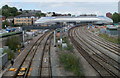
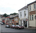
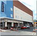
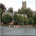
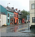
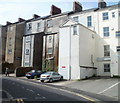
100 photos from this area
Area Information
Key information about the NP20 5BP including its size, population, and administrative classification.
- Area Type
- Postcode
- Area Size
- 1.8 hectares
- Population
- Not available
- Population Density
- Not available
House Prices in NP20 5BP
34
Properties
£215,231
Average Sold Price
£32,000
Lowest Price
£540,000
Highest Price
Showing 34 properties
| Address | Type | Beds | Baths | Last Sale Price | Last Sale Date | |
|---|---|---|---|---|---|---|
| 33A Fields Road, Newport, NP20 5BP | Maisonette | 3 | 1 | £260,000 | Jun 2023 | |
| 34 Fields Road, Newport, NP20 5BP | Semi-detached | 5 | 1 | £425,000 | Apr 2021 | |
| 33 Fields Road, Newport, NP20 5BP | Flat | 2 | 1 | £138,000 | Sep 2019 | |
| 53 Fields Road, Newport, NP20 5BP | Detached | 5 | 1 | £500,000 | May 2019 | |
| 41B Fields Road, Newport, NP20 5BP | Flat | - | - | £145,000 | Nov 2018 | |
| 41A Fields Road, Newport, NP20 5BP | Flat | - | - | £133,500 | Mar 2018 | |
| 39 Fields Road, Newport, NP20 5BP | house | - | - | £335,000 | Aug 2017 | |
| 40 Fields Road, Newport, NP20 5BP | Semi-detached | 6 | 2 | £290,000 | Jan 2016 | |
| 57 Fields Road, Newport, NP20 5BP | Maisonette | - | - | £95,000 | Aug 2015 | |
| 56 Fields Road, Newport, NP20 5BP | Flat | 4 | 1 | £130,000 | Oct 2014 |
Page 1 of 4
Energy Efficiency in NP20 5BP
Amenities
Schools
| Rank | School | Type | Entry gender | Ages |
|---|
Explore more schools in this area
Go to Schools tabDemographics
Household Size
One person
most common
Accommodation Type
Houses
most common
Tenure
63
majority
Ethnic Group
White
most common
Religion
N/A
most common
Household Composition
N/A
most common
Age
47
median
Adults (30-64 years)
most common
Household Deprivation
N/A
with no deprivation
NS-SEC
41
in Lower managerial occupations
Explore more demographic insights in this area
Go to Demographics tabPlanning
Planning Constraints
- Flood RiskPremium
- Ramsar Wetland SitesPremium
- Area of Outstanding Natural BeautyPremium
- Protected Nature ReservePremium
- Protected WoodlandPremium
- Crime RiskPremium