Area Overview for NP20 3DF
Photos of NP20 3DF
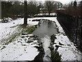
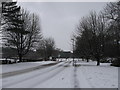
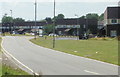
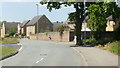
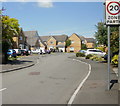
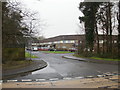
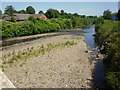
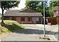

100 photos from this area
Area Information
Key information about the NP20 3DF including its size, population, and administrative classification.
- Area Type
- Postcode
- Area Size
- 8541 m²
- Population
- 1719
- Population Density
- 4669 people/km²
House Prices in NP20 3DF
24
Properties
£95,389
Average Sold Price
£37,000
Lowest Price
£150,000
Highest Price
Showing 24 properties
| Address | Type | Beds | Baths | Last Sale Price | Last Sale Date | |
|---|---|---|---|---|---|---|
| 44 Maesglas Road, Newport, NP20 3DF | Terraced | 3 | 2 | £150,000 | Jan 2023 | |
| 77 Maesglas Road, Newport, NP20 3DF | Terraced | 3 | 1 | £135,000 | Nov 2022 | |
| 75 Maesglas Road, Newport, NP20 3DF | Terraced | 3 | - | £112,000 | Dec 2019 | |
| 69 Maesglas Road, Newport, NP20 3DF | Terraced | 3 | 2 | £116,000 | Sep 2019 | |
| 60 Maesglas Road, Newport, NP20 3DF | Semi-detached | 3 | - | £95,000 | Nov 2016 | |
| 36 Maesglas Road, Newport, NP20 3DF | house | 3 | - | £69,000 | Feb 2007 | |
| 63 Maesglas Road, Newport, NP20 3DF | house | - | - | £90,500 | Jul 2006 | |
| 79 Maesglas Road, Newport, NP20 3DF | house | - | - | £54,000 | Jan 2003 | |
| 56 Maesglas Road, Newport, NP20 3DF | house | 2 | - | £37,000 | Feb 1997 | |
| 46 Maesglas Road, Newport, NP20 3DF | house | - | - | - | - |
Page 1 of 3
Energy Efficiency in NP20 3DF
Amenities
Schools
| Rank | School | Type | Entry gender | Ages |
|---|
Explore more schools in this area
Go to Schools tabDemographics
Household Size
Family (3-5 people)
most common
Accommodation Type
Houses
most common
Tenure
43
majority
Ethnic Group
White
most common
Religion
N/A
most common
Household Composition
N/A
most common
Age
47
median
Adults (30-64 years)
most common
Household Deprivation
N/A
with no deprivation
NS-SEC
19
in Lower managerial occupations
Explore more demographic insights in this area
Go to Demographics tabPlanning
Planning Constraints
- Flood RiskPremium
- Ramsar Wetland SitesPremium
- Area of Outstanding Natural BeautyPremium
- Protected Nature ReservePremium
- Protected WoodlandPremium
- Crime RiskPremium