Area Overview for NP19 9NY
Photos of NP19 9NY
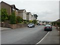
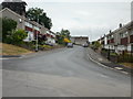
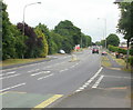
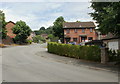
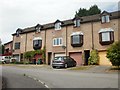

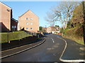
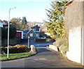
95 photos from this area
Area Information
Key information about the NP19 9NY including its size, population, and administrative classification.
- Area Type
- Postcode
- Area Size
- 1.8 hectares
- Population
- 1913
- Population Density
- 5625 people/km²
House Prices in NP19 9NY
41
Properties
£94,086
Average Sold Price
£35,000
Lowest Price
£160,000
Highest Price
Showing 41 properties
| Address | Type | Beds | Baths | Last Sale Price | Last Sale Date | |
|---|---|---|---|---|---|---|
| 35 John Ireland Close, Newport, NP19 9NY | house | - | - | £160,000 | Apr 2023 | |
| 13 John Ireland Close, Newport, NP19 9NY | house | - | - | £128,000 | Jun 2021 | |
| 2 John Ireland Close, Newport, NP19 9NY | Terraced | 3 | 1 | £110,000 | Feb 2017 | |
| 4 John Ireland Close, Newport, NP19 9NY | Terraced | 3 | - | £90,000 | Jan 2017 | |
| 3 John Ireland Close, Newport, NP19 9NY | Terraced | 3 | 1 | £94,950 | Nov 2016 | |
| 38 John Ireland Close, Newport, NP19 9NY | house | - | - | £65,000 | Feb 2015 | |
| 41 John Ireland Close, Newport, NP19 9NY | house | - | - | £75,000 | Dec 2011 | |
| 17 John Ireland Close, Newport, NP19 9NY | Semi-detached | - | - | £94,000 | Nov 2008 | |
| 21 John Ireland Close, Newport, NP19 9NY | Semi-detached | - | - | £95,000 | Oct 2005 | |
| 30 John Ireland Close, Newport, NP19 9NY | Terraced | - | - | £88,000 | Dec 2004 |
Page 1 of 5
Energy Efficiency in NP19 9NY
Amenities
Schools
| Rank | School | Type | Entry gender | Ages |
|---|
Explore more schools in this area
Go to Schools tabDemographics
Household Size
Family (3-5 people)
most common
Accommodation Type
Houses
most common
Tenure
40
majority
Ethnic Group
White
most common
Religion
N/A
most common
Household Composition
N/A
most common
Age
47
median
Adults (30-64 years)
most common
Household Deprivation
N/A
with no deprivation
NS-SEC
16
in Lower managerial occupations
Explore more demographic insights in this area
Go to Demographics tabPlanning
Planning Constraints
- Flood RiskPremium
- Ramsar Wetland SitesPremium
- Area of Outstanding Natural BeautyPremium
- Protected Nature ReservePremium
- Protected WoodlandPremium
- Crime RiskPremium