Area Overview for NP19 9EY
Photos of NP19 9EY

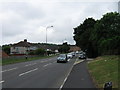
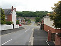
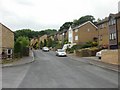
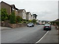
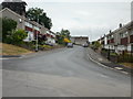
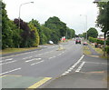
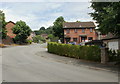
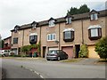

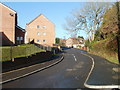
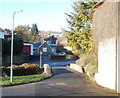
95 photos from this area
Area Information
Key information about the NP19 9EY including its size, population, and administrative classification.
- Area Type
- Postcode
- Area Size
- 9956 m²
- Population
- 1643
- Population Density
- 4050 people/km²
House Prices in NP19 9EY
20
Properties
£145,071
Average Sold Price
£64,000
Lowest Price
£249,995
Highest Price
Showing 20 properties
| Address | Type | Beds | Baths | Last Sale Price | Last Sale Date | |
|---|---|---|---|---|---|---|
| 642 Chepstow Road, Newport, NP19 9EY | house | - | - | £168,500 | Dec 2015 | |
| 658 Chepstow Road, Newport, NP19 9EY | Detached | 3 | - | £185,000 | Aug 2015 | |
| 646 Chepstow Road, Newport, NP19 9EY | Detached | 4 | - | £249,995 | Jul 2013 | |
| 634 Chepstow Road, Newport, NP19 9EY | Detached | 3 | 1 | £179,000 | Jan 2011 | |
| 632 Chepstow Road, Newport, NP19 9EY | Semi-detached | 3 | - | £94,000 | Jun 2002 | |
| 656 Chepstow Road, Newport, NP19 9EY | Semi-detached | - | - | £75,000 | Sep 2000 | |
| 652 Chepstow Road, Newport, NP19 9EY | Semi-detached | - | - | £64,000 | Mar 1997 | |
| 668 Chepstow Road, Newport, NP19 9EY | Bungalow | 3 | 1 | - | - | |
| 640 Chepstow Road, Newport, NP19 9EY | Semi-detached | 3 | 1 | - | - | |
| The Flat, 646 Chepstow Road, Newport, NP19 9EY | Flat | - | - | - | - |
Page 1 of 2
Energy Efficiency in NP19 9EY
Amenities
Schools
| Rank | School | Type | Entry gender | Ages |
|---|
Explore more schools in this area
Go to Schools tabDemographics
Household Size
One person
most common
Accommodation Type
Houses
most common
Tenure
54
majority
Ethnic Group
White
most common
Religion
N/A
most common
Household Composition
N/A
most common
Age
47
median
Adults (30-64 years)
most common
Household Deprivation
N/A
with no deprivation
NS-SEC
27
in Lower managerial occupations
Explore more demographic insights in this area
Go to Demographics tabPlanning
Planning Constraints
- Flood RiskPremium
- Ramsar Wetland SitesPremium
- Area of Outstanding Natural BeautyPremium
- Protected Nature ReservePremium
- Protected WoodlandPremium
- Crime RiskPremium